Alert News
- Home
- Alert News
- 28-01-2025
Dear member of Geologica Belgica Luxemburga Scientia & Professionis
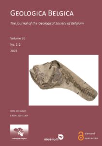
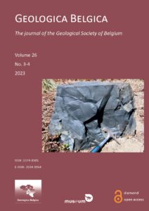
Don’t forget to look in the hidden area for the GBLsp members that the entire electronic volume (in PDF) are available to download covering the year 2023 – VOL 26
- 09-01-2025
Dear member of Geologica Belgica Luxemburga Scientia & Professionis
As every year, we would like to invite you to pay your GBLsp membership fee for 2025. Please note that GBLsp membership is set for a calendar year so from 1st January to 31 December 2025. In order to proceed look at the following prices, select the one and renew it with the bank information hereafter or if you’re willing to join, go to this page and fill in the form:
- 45€ (or 70€ including printed Journal)
- 22,5€ for unemployed, PhD students and recently graduated geologists
- Free for Master students
If not done yet, please pay your 2025 fee by end of March 2025 on the GBLsp account BE05 0689 4773 3675 BIC GKCCBEBB with following communication: « 2025 GBLsp fee – [your name] ». Kind regards, The GBLsp Board
- 08-01-2025
2025 series of our Lunch & Learn webinars with the first talk “The lower fast spreading oceanic crust and its interactions with fluids”, presented by Romain Meyer, on 15/01/2025 from 12:15 to 13:15.
No registration required for GBLsp members look to the Teams Link in the GBLsp news email, non-GBLsp members -> please contact us for the Teams link.
Romain Meyer’s BIO:
Romain Meyer is an earth scientist from Luxembourg.He earned bachelor’s degrees in Geology and Mineralogy, followed by a Diploma in Mineralogy from the Friedrich Schiller University in Jena, Germany. He completed his PhD at KU Leuven, working in the laboratories of Prof. Jan Hertogen, where he studied the rift-to-drift transition and the opening of the NE Atlantic.
After his PhD, Romain moved to the United States as a postdoctoral researcher at the Massachusetts Institute of Technology (MIT) and later became a geology professor at the Washington and Lee University in Lexington, Virginia. At the Norwegian Center of Excellence for Geobiology and simultaneously the University of Bergen’s Department of Earth Science, he shifted his research focus back to the NE Atlantic and the oceanic crust. But Romain’s interests in geology stayed always diverse. His research is driven by specific questions and spans a wide range of topics, including traditional hard rock geology, fluid-rock interactions, medical geology, geoarchaeology, and geotechnical problem-solving. Today, Romain works at the Service géologique du Luxembourg. More details here: Lunch & Learn page
- 05-01-2025
GBLsp wishes you a Happy New Year 2025 to all our (new) members and followers
-
-
- 11-03-2022
-
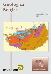
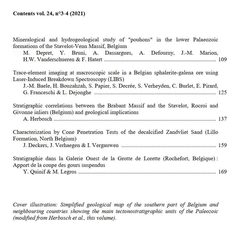
The 2021 volumes of Geologica Belgica are published
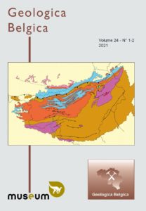
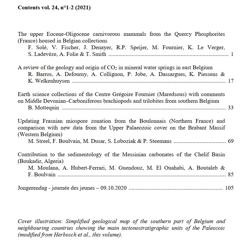
To all our members, the two volumes for the year 2021 (vol 1-2 & vol 3-4) are published and available already in PDF to download from the member section in the publication page.
Hereafter the pictures of the cover page and the contents
-
-
-
-
- 07-02-2022
-
-
-
Orbituary – Alain Blieck
Geologica Belgica has the regret to announce that our French colleague and retired Prof Alain Blieck from the University of Lille deceased from the Covid. He was 72 years old.
Alain Robert Maurice Blieck, a former CNRS senior scientist, has retired, and works at home. I continue doing research in Evolutionary Biology, Palaeobiology and Systematics (Taxonomy, Nomenclature, Phylogeny), Palaeoecology, Biostratigraphy, and Palaeobiogeography. My main focus is on earliest vertebrates and, in particular, jawless ossified Palaeozoic groups known as ostracoderms. I more precisely study Pteraspidomorphs that are known from the Ordovician to the Devonian, with special attention to Eodevonian (Early Devonian) faunas from the Old Red Sandstone Continent (Spitsbergen, Arctic Russia and Canada, Europe, USA …).
To see and remember his publications : search on his Researchgate account
-
-
-
-
- 05-01-2022
-
-
-
Happy New Year 2022 to all GB members
Geologica Belgica would like to wish you all a fantastic and challenging year.
-
-
-
-
- 10-11-2021
-
-
-
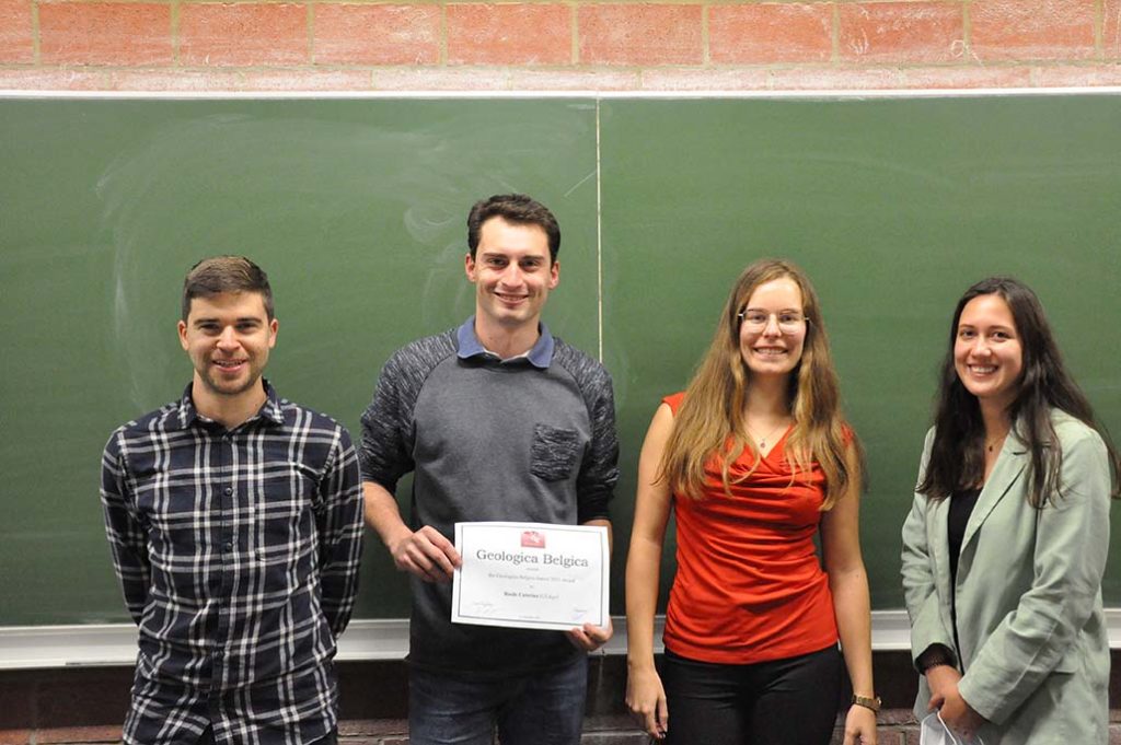
Geologica Belgica 2021 Master Day meeting, 15th October in Namur
9 particpants this year presented their Ma thesis results at the University of Namur
The awarded laureate this year was Basile Caterina from ULiège with his Ma thesis entitled “Sedimentary processes in straits based on outcrop analogue and oceanographic data in the rift of Corinth (Greece)“
If you are interested to know the different Master thesis title and more, please visit the dedicated webpage
-
-
-
-
- 2-06-2021
-
-
-
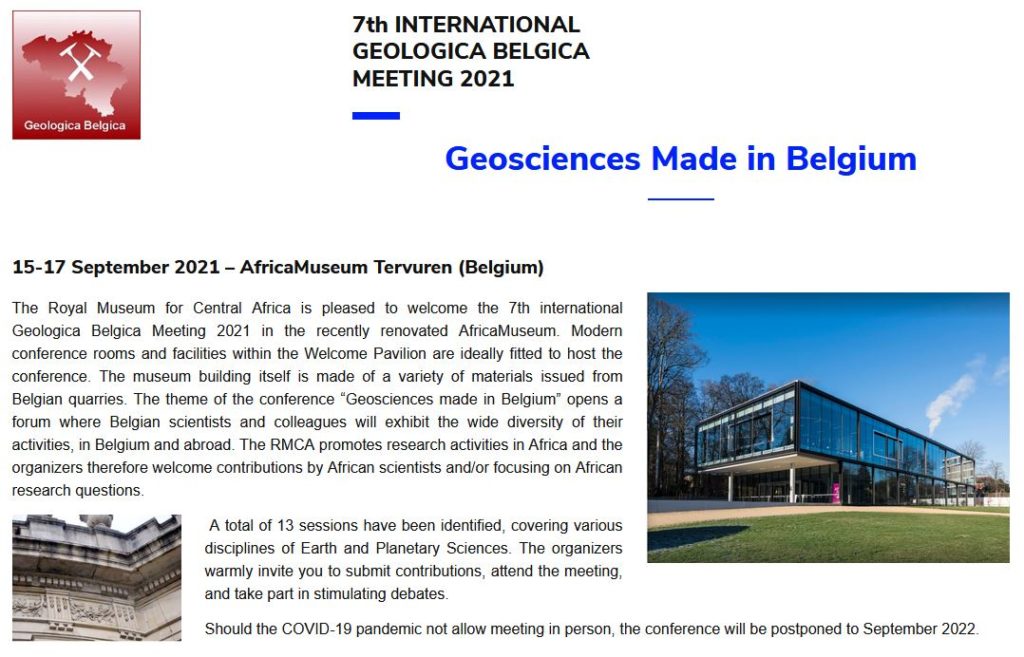
Geologica Belgica 2021 meeting, 15-17 September, Tervuren
! Extension of deadline for abstract submission !
Dear colleagues,
The organization of the 7th International Geologica Belgica Meeting 2021 in the AfricaMuseum in Tervuren is progressing well.
We have already received a good number of abstracts, but we would like to offer the possibility for submission of more abstracts. The deadline for submission of abstract has been extended to June 30th.
The new deadline has been updated on the web site: (https://geologicabelgica2021.africamuseum.be)..
Please spread this information to to your colleagues and students.
Kind Regards
Damien Delvaux, for the Organizing Committee.
-
-
-
-
- 1-06-2021
-
-
-
Geoscience, Policy and Society. Transatlantic Perspectives of Geological Surveys. Online event – 7 to 11 June 2021, 10.00 am (EST) / 4.00 pm (CEST)
The online event Geoscience, Policy and Society (GPS) 2021 aims to discuss the crucial role of the subsurface and its resources in the transition to a sustainable future.
The reorganization of our society with focus on renewable energy, sustainable use of resources, and low-climate impact, remains high on European and international agendas. One aspect that receives insufficient attention is the crucial role of the subsurface and its resources in this transition.A better understanding of subsurface processes, linked potential, and the consequences of any actions, whether intended or not, can ensure the safe and sustainable development of these resources, as well as reveal new opportunities of subsurface use. This understanding is therefore the crucial baseline for sound policies, including subsurface resource management and spatial planning.
This event is being organized by Geological Survey Organizations in Europe – BRGM, GBA, GSB and EGS, and the U.S. Geological Survey, which have been engaged in providing the needed science for improved sustainable subsurface management and policy. It addresses policy makers, regulators, interest groups, geoscientists and representatives from industry and the research community dealing with the multiple uses and management of underground resources. We also welcome anyone with a broad interest in geoscience to join the discussions.
More details on date, events organised, conferences, talks, … : you can download either the flyer or the extended flyer !
-
-
-
-
- 13-04-2021
-
-
-
Neanderthals discoveries
Oldest DNA from a Homo sapiens reveals surprisingly recent Neanderthal ancestry. Ancient human lineages interbred commonly in Europe, as well as the Middle East. The four-story labyrinth of galleries in Bulgaria’s Bacho Kiro cave has long been a magnet for all sorts of humans. Neanderthals came first, more than 50,000 years ago, and left their characteristic Mousterian stone tools among the stalagmites. Next came modern humans in at least two waves; the first littered the cave floor with beads and stone blades stained with ochre, about 45,000 years ago. Another group settled in about 36,000 years ago with even more sophisticated artifacts.
Now, a new ancient DNA study shows the first group of modern humans at Bacho Kiro carried a recent legacy from Neanderthals: Those people’s ancestors had interbred with our extinct cousins as recently as six generations, or 160 to 180 years, previously.
However, another study out today, of what may be the oldest modern human in Europe, shows the first wave of moderns had diverse Neanderthal legacies. The genome of a dark-skinned, brown-haired, brown-eyed woman from Zlatý kůň cave in the Czech Republic included only 3% Neanderthal DNA, which likely came from a long-ago tryst in the Middle East, not from recent contact, the study suggests. (More details can be found on the Nature website).
-
-
-
-
- 05-04-2021
-
-
-
7th International Geologica Belgica Meeting 2021
The Organizing and the Scientific Committees are pleased to announce that the 7th International Geologica Belgica Meeting 2021 will be held in the Africa Museum in Tervuren (at the southern outskirt of Brussels, Belgium) on the 15-17 September 2021, with as general topic: Geology Made in Belgium.
If you’re interested to participate/register -> please consult the website for more details: [https://geologicabelgica2021.africamuseum.be/https://geologicabelgica2021.africamuseum.be/]
-
-
-
-
- 09-03-2021
-
-
-
Printed volume 23/1-2 from 2020
The new volume printed out is available in the Member section area with individual links to each published paper in PDF.
- Franck R.A DELPOMDOR, Archange M. ILAMBWETSI, Fabricío A. CAXITO & Antonio C. PEDROSA-SOARES
New interpretation of the basal Bambuí Group, Sete Lagoas High (Minas Gerais, E Brazil) by sedimentological studies and regional implications for the aftermath of the Marinoan glaciation: Correlations across Brazil and Central Africa- Allart P. VAN VIERSEN & Peter TAGHON
A poorly diversified trilobite association from the lower Emsian (Lower Devonian) in the Sankt Vith area (East Belgium)- Luciane LICOUR, Pascal GODERNIAUX, Nicolas DUPONT, Michel HENNEBERT, Rudy SWENNEN, Philippe STEEMANS, Frédéric BOULVAIN, Estelle PETITCLERC, Alain RORIVE & Jean-Marc BAELE
Stratigraphical reinterpretation of Devonian strata underlying the Mons Basin based on cuttings from the Saint-Ghislain borehole, Hainaut, Belgium- François BAUDIN, Christophe RABOUILLE & Bernard DENNIELOU
Routing of terrestrial organic matter from the Congo River to the ultimate sink in the abyss: a mass balance approach – André Dumont medallist lecture 2017- Denis TURIMUMAHORO, Niels HULSBOSCH, Louis NAHIMANA, Stijn DEWAELE & Philippe MUCHEZ
Géochimie des muscovites comme indicateur du fractionnement des pegmatites de la région de Kabarore-Mparamirundi (nord-ouest du Burundi, Afrique centrale)- Pascal MAMBWE, Franck DELPOMDOR, Sébastien LAVOIE, Philippe MUKONKI, Jacques BATUMIKE & Philippe MUCHEZ
Sedimentary evolution and stratigraphy of the ~765–740 Ma Kansuki-Mwashya platform succession in the Tenke-Fungurume Mining District, Democratic Republic of the Congo- JONGERENDAG – JOURNEE DES JEUNES – 18.10.2019 Abstracts of communications presented at the ‘Master Day’ meeting, Gent
-
-
-
-
- 01-03-2021
-
-
-
The Jezero crater on Mars
After the successful landing of the rover Perseverance inside the Jezero Crater on Mars by NASA, there is plenty of new options to follow a bit more in details this mission.
For those interested, here follows a few links to go deeper and learn much more:
– The location of Perseverance on an satellite imagery viewer allow to see its position in the crater -> click here
– The main site of the NASA to discover the rover mission and amazing images from Mars -> click here to discover the dedicated website
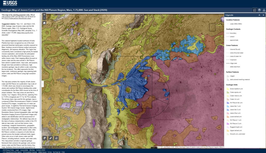
– If you want to discover the geological map of the Jezero Crater made available from USGS [Geologic Map of Jezero Crater and the Nili Planum Region, Mars Scientific Investigations Map 3464,Prepared for the National Aeronautics and Space Administration made by: Vivian Z. Sun and Kathryn M. Stack -> click here to find the link to download the PDF
– For those having a Twitter account, Perseverance has its own account there -> search the Twitter account: https://twitter.com/NASAPersevere
– The online interactive Geologic Map of Jezero Crater and the Nili Planum Region, Mars, 1:75,000. Sun and Stack (2020) -> click here
-
-
-
-
- 09-02-2021
-
-
-
ESA seeks new astronauts
ESA seeks new astronauts
For the first time in 11 years, ESA is looking for new astronauts. These recruits will work alongside ESA’s existing astronauts as Europe enters a new era of space exploration.
Media representatives are invited to a virtual press event on Tuesday, 16 February, to learn more about the vacancies that are intended to initiate a real generational change for ESA.
The starting point for this is 31 March 2021, when the vacancies for new astronauts open. ESA is strongly encouraging women to apply, because we are seeking to expand gender diversity in our ranks.
More details here at: ESA Press Room
-
-
-
-
- 28-01-2021
-
-
-
New open-access community and journals
After a successful start with Volcanica in 2018 @WeAreVolcanica, three new community-led diamond open access journals are forthcoming in 2021 (-> i.e. Sedimentologika, Tektonika, Seismica, and the first one JVolcanica). Choose the one you prefer, and follow them on twitter for example #openaccess before official launch.
-
-
-
-
- 19-01-2021
-
-
-
UNESCO lecture serie in Earth Materials Sustainability – 26 January 2021
Earth Materials Sustainability – Date: Tuesday, January 26, 2021 to Thursday, April 1, 2021
UNESCO Lecture Series – Earth Materials for a Sustainable and Thriving Society
Organised in collaboration with IUGS and iCRAG
Date: Starting 26 January 2021
Registration: Click here.
Download your information flyer here:
UNESCO lecture series_English
UNESCO lecture series_FrenchMinerals and other Earth materials are a key component in the development of a sustainable global society, providing essential raw materials for technologies and economic growth while respecting the natural world. This programme of lectures, designed for a global audience, will provide diverse perspectives on Earth materials and their role in society. Leading natural scientists, social scientists, and educators will look at how Earth materials are critical to a sustainable future and how the minerals sector, adhering to best practices, can contribute to society in a socially and environmentally positive way.
The lectures will be delivered in webinar format by recognized global experts who will frame their presentations in the context of the United Nations Sustainable Development Goals. The Series will boost knowledge of Earth materials and contribute to better informed local, regional, and international discussions. The lectures will be freely accessible and recordings will be made available online soon after presentation.
The Lecture Series is sponsored by UNESCO, the only United Nations organization with a mandate to support research and capacity building in the Earth Sciences. The Series supports the vision of UNESCO’s International Geoscience Programme for efficient, safe, sustainable and renewable natural resources exploration and extraction.
UNESCO is the only United Nations organization with a mandate to support research and capacity building in the Earth Sciences.
The UNESCO International Geoscience Programme (IGCP) serves as a knowledge hub of UNESCO to facilitate international scientific cooperation in the geosciences.
The International Union of Geological Sciences (IUGS) encourages international co-operation and participation in the Earth Sciences in relation to human welfare.
iCRAG, the Science Foundation Ireland Research Centre for Applied Geosciences, is a team of researchers creating solutions for a sustainable society.All sessions will be conducted in English with live captioning in French, Spanish, Portuguese, Arabic, Swahili, and Hindi.
All sessions will include a live public question and answer period with the presenters immediately following the lecture presentations.
SessionsAll sessions will be recorded and links to the recordings will be available on this webpage a few days after each event.
- Earth materials: the foundation for development – Jan 26, 2021
Join Link: https://www.earthmaterials.org/unesco/lecture1
Start time: 05.00 (Vancouver) * 08.00 (Toronto, Lima) * 13.00 (London) * 14.00 (Paris, Lagos) * 15.00 (Johannesburg) * 16.00 (Nairobi) * 18.30 (Mumbai) * 19.00 (Dhaka) * 21.00 (Beijing) * 22.00 (Tokyo) * 00.00+1 (Sydney).
Introductory remarks from Dr. Shamila Nair-Bedouelle, Assistant Director-General for Natural Sciences, UNESCO, and Dr. John Ludden CBE, Bicentennial Research Professor, Environmental Governance and Diplomacy, Heriot-Watt University, UK.
Speakers
Dr Larry Meinert, Meinert Consulting LLC, Delaware, USA.
Dr Nellie Mutemeri, Mining Practice Lead, Mutemeri Consulting and Associate Professor, University of Witwatersrand, South Africa.Review of historical and present-day mineral demand and its connections to the economy and technology
Historical context globally – why Earth materials are important
Technological evolution and climate neutrality are creating demand for new mineral portfolios
Mineral wealth and the SDGs, including wealth and social justice
- Climate neutrality, the circular economy, and earth materials – 2 February, 2021
Join Link: https://www.earthmaterials.org/unesco/lecture2
Start time: 07.00 (Vancouver) * 10.00 (Toronto, Lima) * 15.00 (London) * 16.00 (Paris, Lagos) * 17.00 (Johannesburg) * 18.00 (Nairobi) * 20.30 (Mumbai) * 21.00 (Dhaka) * 23.00 (Beijing) * 00.00+1 (Tokyo) * 02.00+1 (Sydney)
Speakers
Prof. John Thompson, PetraScience Consultants, Vancouver, Canada and Honorary Professor of Sustainable Resources, University of Bristol, UK.
Prof. Frances Wall, Professor of Applied Mineralogy, University of Exeter, UK.Reimagining metal supply to meet demand and societal expectations
Current and emerging demand drivers
Circular economy – importance and challenges
Moving to efficient and responsible primary extraction
Joining up the value chain
- The neglected minerals and materials of development – 9 February 2021
Join Link: https://www.earthmaterials.org/unesco/lecture3
Start time: 01.00 (Vancouver) * 04.00 (Toronto, Lima) * 09.00 (London) * 10.00 (Paris, Lagos) * 11.00 (Johannesburg) * 12.00 (Nairobi) * 14.30 (Mumbai) * 15.00 (Dhaka) * 17.00 (Beijing) * 18.00 (Tokyo) * 20.00 (Sydney)
Speaker
• Prof. Daniel Franks Program Leader, Sustainable Minerals Institute, University of Queensland, Australia.Materials produced and consumed locally (in both developing and developed countries)
o Bulk materials, generally for nearby use
o Role in construction, infrastructure, agriculture, water treatment, etc.
o Environmental, social, and economic dimensions
- Mineral extraction and communities – 16 February 2021
Join Link: https://www.earthmaterials.org/unesco/lecture4
Start time: 06.00 (Vancouver) * 09.00 (Toronto, Lima) * 14.00 (London) * 15.00 (Paris, Lagos) * 16.00 (Johannesburg) * 17.00 (Nairobi) * 19.30 (Mumbai) * 20.00 (Dhaka) * 22.00 (Beijing) * 23.00 (Tokyo) * 01.00+1 (Sydney)
Speakers
Dr Rajiv Maher, Research Professor, EGADE Business School del Technológico de Monterrey, Mexico.
Dr Melba Kapesa Wasunna, External Affairs Manager, Base Titanium Ltd., Kenya.Regulation of the mining sector; mining and local communities in the context of Latin America and Africa
Social justice and sustainability: the challenge of social acceptance and license
The importance of governance: Regulation and oversight of mining operations
Case studies and best practices
- Suppliers, consumers, and the global minerals supply chain – 2 March 2021
Join Link: https://www.earthmaterials.org/unesco/lecture5
Start time: 02.00 (Vancouver) * 05.00 (Toronto, Lima) * 10.00 (London) * 11.00 (Paris, Lagos) * 12.00 (Johannesburg) * 13.00 (Nairobi) * 15.30 (Mumbai) * 16.00 (Dhaka) * 18.00 (Beijing) * 19.00 (Tokyo) * 21.00 (Sydney)
Speakers
Dr Kathryn Moore, Senior Lecturer in Critical and Green Technology Metals, University of Exeter, UK.
Dr Judy Muthuri, Associate Professor of Corporate Social Responsibility, Nottingham University Business School, UK, and Project Lead, Sustainable Artisanal and Small-scale Mining Project (Kenya).Technical, environmental, business, and social aspects of different scales of mining operations; links between consumers and source
How supply chains work from source to use
Differentiating large-scale, high-tech small-scale, and artisanal mining sectors
Processing, refining, manufacturing sectors
Stakeholders, responsible sourcing programmes, and their impacts– Earth materials and a sustainable future – 9 March 2021
Join Link: https://www.earthmaterials.org/unesco/lecture6
Start time: 04.00 (Vancouver) * 07.00 (Toronto, Lima) * 12.00 (London) * 13.00 (Paris, Lagos) * 14.00 (Johannesburg) * 15.00 (Nairobi) * 17.30 (Mumbai) * 18.00 (Dhaka) * 20.00 (Beijing) * 21.00 (Tokyo) * 23.00 (Sydney)
Speakers
Prof. Murray Hitzman, Director, iCRAG, Dublin, Ireland. Prof. Hitzman directs the Irish Centre for Research in Applied Geosciences.
Ms Halleluya Naantu Ekandjo, PhD candidate at iCRAG, University College Dublin., where she is studying the Rosh Pinah zinc-lead deposit in Namibia.A reliable, affordable, and just supply of earth materials can be the foundation for a sustainable future and young professionals are the key to that future.
Earth materials and the UN Sustainable Development Goals
Technical, workforce, and social challenges must be addressed at all scales in both developing and developed countries
A vision for the futureClosing remarks by UNESCO representative.
To register for the lecture series please click here.
If you have any queries about the series please contact: unescolectures(at)icrag-centre.org
-
-
-
-
- 19-01-2021
-
-
-
2021 Spring GSA Associated Societies Meeting – 7 April 2021
Dear GSA Associated Society Members,
GSA and AGI invited over 76 Associated Societies to the GSA 2020 Connects Online. The meeting was attended by society representatives, AGI Executive Committee members and staff, and GSA staff. Thank you all for taking part of this meeting.The date for the 2021 Spring GSA Associated Societies Meeting is 7 April 2021. The meeting will be from 8:00 AM – 10:00 AM (MDT). Please RSVP directly to Dominique Olvera by 1 April 2021. GSA is looking forward to having you attend this meeting.
This year the meeting will be again be a “Virtual Meeting.” We hope that this format will continue to allow more Associated Societies in other parts of the world to participate. GSA invites all of you to participate.The Agenda and other pertinent information will be sent at a later date. If you have a topic of discussion or a presentation that would be of interest, please send your information to Dominique Olvera no later than 15 March 2021. If the roles of your organization have changed, please send updated information to Dominique Olvera.
Additionally, we would like to request that this GSA Connects 2021 Meeting in Portland, Oregon information be posted to your society website.
Thank you and best regards,
Dominique Olvera
Governance and Awards Manager
dolvera@geosociety.org
-
-
-
-
- 05-01-2021
-
-
-
Happy New Year 2021 – Geologica Belgica wishes a fantastic scientific year to all the members
-
-
-
-
- 14-10-2020
-
-
-
MASTER DAY – 09/10/2020
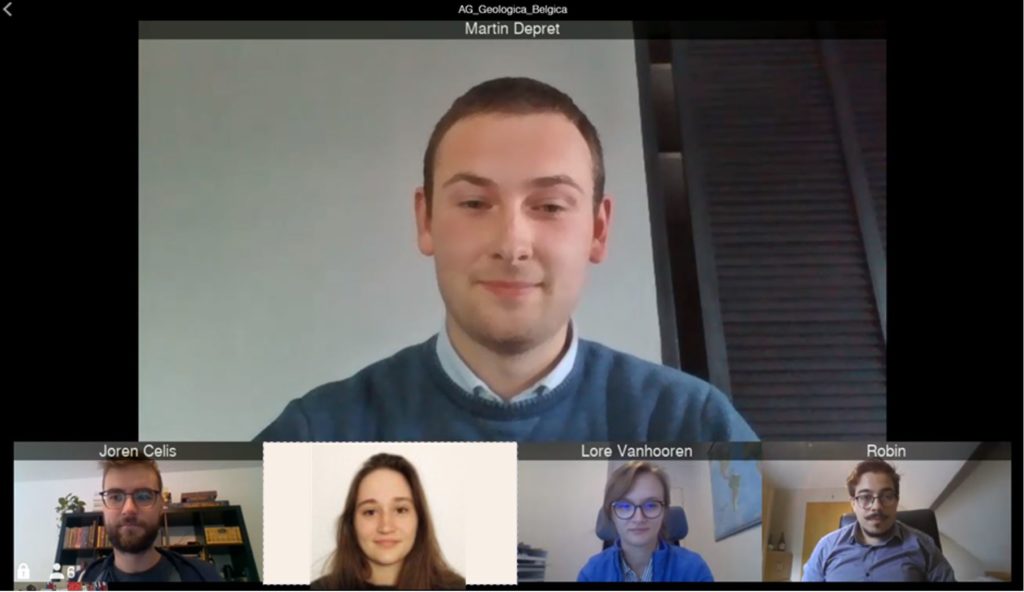
Thanks to the 5 excellent virtual Master student presentations and congratulations to the 2020 laureate -> Martin Depret for his presentation. If you want more details, go to the Master Day page !
-
-
-
-
- 08-10-2020
-
-
-
GENERAL ASSEMBLY AND MASTER DAY – 09/10/2020
!! PLEASE NOTE THAT BOTH EVENTS ARE PLANNED EXCLUSIVELY ONLINE !!
The General Assembly and the 2020 master Day will be hold fully remotely following our gouvernemental recommendation.
For the open AG and master Day, the link using the platform Lifesize will be the same and please contact Annick Anceau (a.anceau(at)uliege.be) if you want to participate remotely and ask her the details on how to join us either for the General Assembly either for the Master Day or for both.Thanking you in advance and join us online !!!!
-
-
-
-
- 06-10-2020
-
-
-
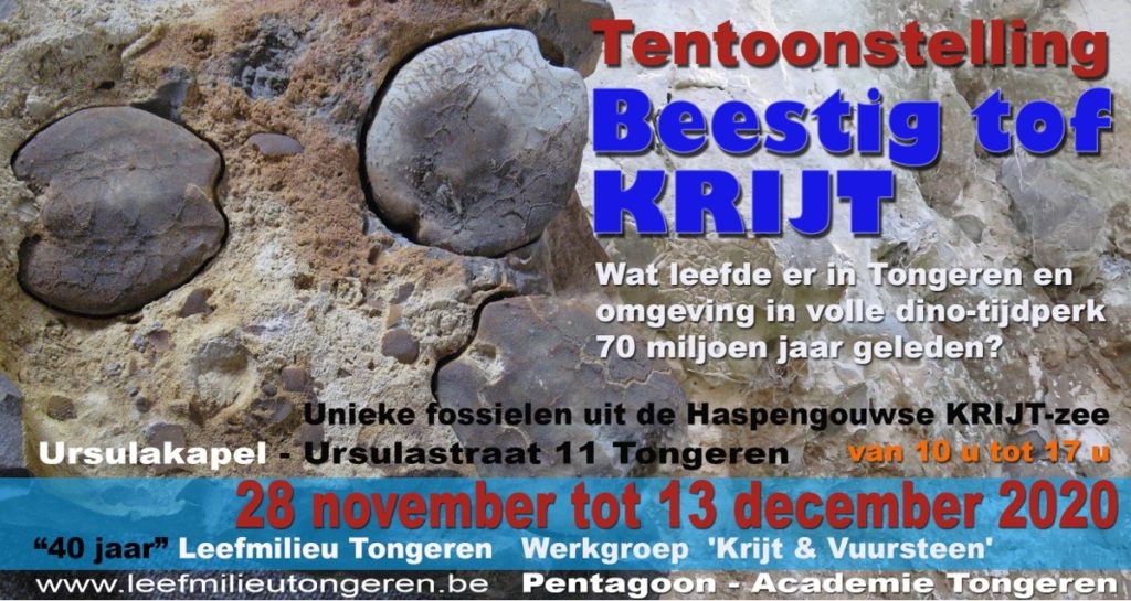
Tentoonstelling Beestig tof KRIJT – Tongeren – van 28 november tm 13 december 2020
Beestig tof KRIJT
Leefmilieu Tongeren bestaat 40 jaar. De vereniging plant, in dit kader, in nauwe samenwerking met de Werkgroep Krijt & Vuursteen de boeiende tentoonstelling “Beestig tof KRIJT”. De jeugdige kunstenaars van Pentagoon Academie-Tongeren werken aan een verrassend artistiek decor.
Nauwelijks voor te stellen, maar 70 miljoen jaar geleden was Zuid-Limburg een subtropische zeebodem waar het krioelde van zeeleven. Massa’s zee-egels, slakken, tweekleppigen, inktvissen, ammonieten, armpotigen, sponzen, haaien, straalvinnige vissen soms ook zee-dino’s. Allemaal vertegenwoordigers van een uitbundige biodiversiteit.
De tentoonstelling toont ruim 300 grote en kleine unieke fossielobjecten, geduldig verzameld door de Werkgroep Krijt & Vuursteen.
Een belangrijk deel hiervan werd gevonden op het grondgebied van Tongeren: Sluizen, Diets-Heur, Rutten, Lauw… en bestrijkt een tijdvenster van 68 tot 66 miljoen jaar geleden.
Er wordt ingezoomd op het voorkomen van Krijt in Zuid-Limburg, op het bijzondere einde van de Krijt-periode, 66 miljoen jaar geleden, met brutale vulkaanuitbarstingen in India en een rampzalige komeetinslag in Mexico. Meteen het einde van de grootste dieren aller tijden: de dino’s.
Een foto-overzicht toont de 80 Tongerse kerken, kastelen, boerderijen, woningen, muren… die in belangrijke mate mergel en vuursteen als bouwmateriaal gebruikten. Vaak gaat het om bouwkundig erfgoed dat deel uitmaakt van het historische DNA van Tongeren.
Dat en nog meer weetjes over krijt en vuursteen komen aan bod tijdens deze unieke tentoonstelling.
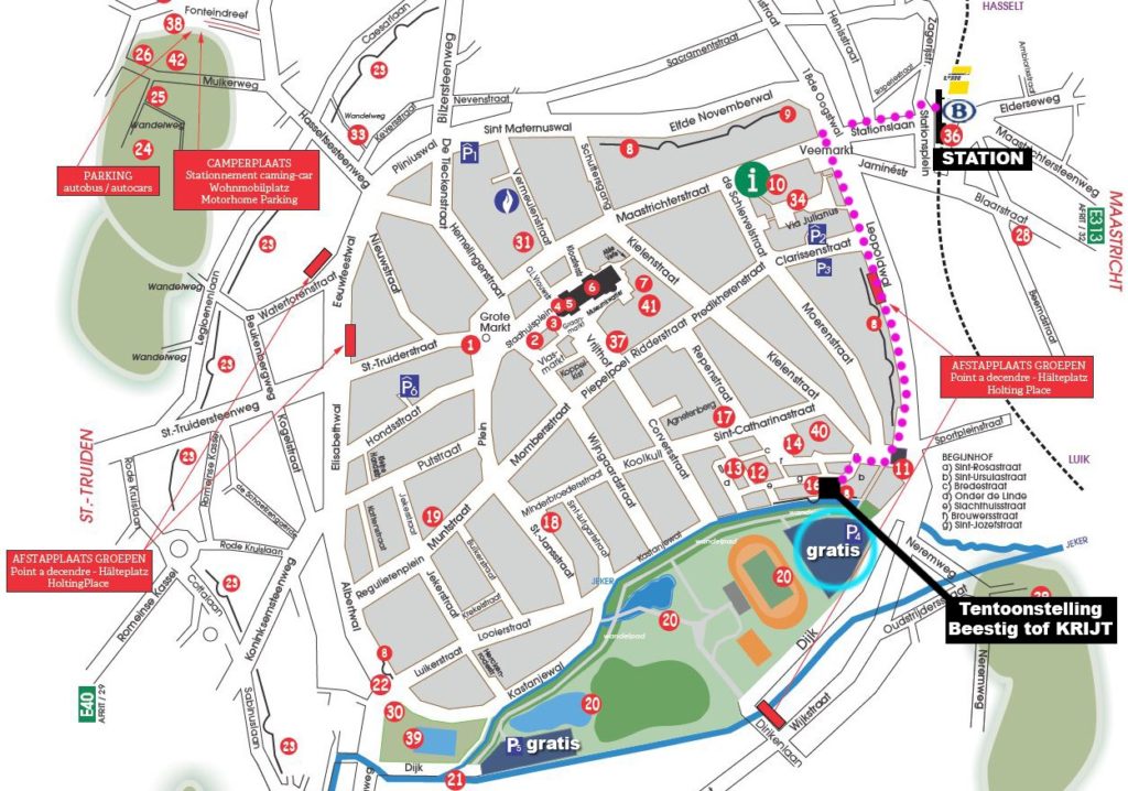
De tentoonstelling is geopend van zaterdag 28 november tot en met zondag 13 december in de Ursulakapel, Begijnhof Ursulastraat 11 te Tongeren en dit van 10 u tot 17 u. Iedereen is van harte welkom. De toegang is gratis. Mondmasker verplicht. Vermijd piekuren.
De Tentoonstelling ligt op 880 m wandelafstand van het trein- en busstation van Tongeren. Gratis parkeerplaats, bereikbaar via Dijk 2 (nabij Moerenpoort).
In dit kader wordt op zondag 29 november een wandeling georganiseerd rond het thema “Natuursteen in Tongeren”. Vertrek om 14 uur aan de Ursulakapel (Ursulastraat 11-Tongeren) (Gratis deelname – Parking Dijk- toegang: Dijk 2 te Tongeren).
Met de Atlas “Natuursteen in Limburgse gebouwen” in de hand verkennen we het boeiende gebruik van natuursteen door de eeuwen heen in het indrukwekkende Tongerse erfgoed.
Gids: Paul Denis. Beperkt aantal deelnemers. Inschrijven kan op dit email: leefmilieutongeren(at)gmail.be.
Meer info: www.leefmilieutongeren.be
-
-
-
-
- 05-10-2020
-
-
-
Neanderthal genes raise risk of serious COVID – Nature publication
Neanderthal genes raise risk of serious COVID
A gene segment that raises the risk of severe COVID-19 was inherited from Neanderthals. In the present, the segment is carried by around 50% of people of South Asian ancestry and 16% of people with European backgrounds. “The genes in this region may well have protected the Neanderthals against some other infectious diseases that are not around today,” says geneticist Svante Pääbo. “And now, when we are faced with the novel coronavirus these Neanderthal genes have these tragic consequences.”
To read the Nature paper, please consult the accelerated article preview online hereThis is a PDF file of a peer-reviewed paper that has been accepted for publication. Although unedited, the content has been subjected to preliminary formatting. Nature is providing this early version of the typeset paper as a service to our authors and readers. The text and figures will undergo copy editing and a proof review before the paper is published in its final form. Please note that during the production process errors may be discovered which could affect the content, and all legal disclaimers apply. Accelerated Article Preview Published online 30 September 2020
Cite this article as: Zeberg, H. et al. The major genetic risk factor for severe COVID-19 is inherited from Neanderthals. Nature https://doi.org/10.1038/s41586-020-2818-3 (2020)
-
-
-
-
- 04-10-2020
-
-
-
GSA 2020 Connects Online MeetingApp – 26-30 October 2020
This online meeting of the Geological Association of America has plenty of topical, technical and special sessions and short courses. Geologica Belgica belongs to the associated societies, so there are some advantages for the GB members to subscribe and participate to this online meeting (go to the member area section to discover them).
Please find more details on the program of the GSA 2020 Connects Online MeetingApp.
-
-
-
-
- 04-10-2020
-
-
-
Lucien Cahen Prize for Geology
Dear GB members,
Do not forget the Lucien Cahen Prize for Geology
In memory of Lucien Cahen and his research in the field of overseas geology, a prize has been set up. This prize, amounting to 2,500 EUR, is intended to reward the author of a highly valued scientific memoir on a subject related to overseas geological sciences.
The applications for this Prize must absolutely reach the Academy’s secretariat by February 1, 2021 at the latest.Please find attached here the rules of this prize.More details on the website of the Royal Academy for Overseas Sciences.
-
-
-
-
- 03-10-2020
-
-
-
General Assembly – 9th october 2020 in Namur followed by the 2020 Master Day
Dear GB members, Do not forget the General Assembly -> download the document.
After the General Assembly, the Master Day 2020 is planned, more details here.
Please remember that the documents of the boards, the PV etc. are available in the hidden Member area under the tag “Consult the Board Meeting documents” !!
-
-
-
-
- 30-09-2020
-
-
-
The website is functional again and the member area is again working
Dear GB members,
Sorry for the inconvenience the last 2 months as we were affected by several problems on the website: database was full and nothing can be modified even the access by the admins was blocked. Fortunately, an IT expert has been able to reach and clean the database. A plugin was installed to clean the database more automatically to avoid again this problem in the future.
After that, in September, a new wordpress interface was automatically updated by the system creating a conflict with some plugins and again the website cannot be updated.
Our sincere apologies for not being able to communicate more faster with you !! Now we are back on all the communication tools !
-
-
-
-
- 26-07-2020
-
-
-
Prof. Dr. Werner Kasig died on June 22nd, 2020
Prof. Kasig was born on June 8, 1936 in Breslau and studied at the Bergakademie Freiberg, the University of Bonn and the RWTH Aachen, where he graduated as a geologist in 1962. He received his doctorate in 1967 and the Venia Legendi at RWTH Aachen University in 1980. After a substitute professorship at the University of Essen, Prof. Kasig took over the teaching and research area “General, Regional and Historical Geology” at the Geological Institute of the RWTH in 1982 until his retirement in 2001.
More details on its orbituary on the RWTH website or here on the PDF document attached.
-
-
-
-
- 26-06-2020
-
-
-
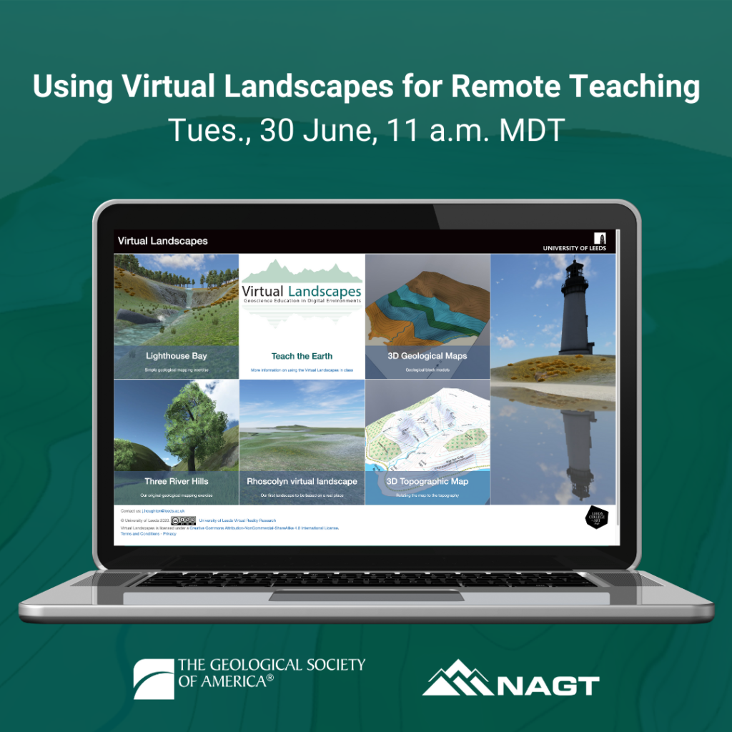
GSA free webinar series “Virtual Landscapes for remote teaching”
Dear GSA Associated Society Leaders,
GSA and NAGT will be hosting a free webinar series “Using Virtual Landscapes for Remote Teaching”. The current scheduled webinar in this series are below. If these are successful, 2-3 additional webinars will be scheduled.
Tuesday, June 30, 11 a.m. MDT Gigapan or 7 pm Brussels time
More details about this webinar: Virtual Landscapes Abstract
-
-
-
-
- 21-06-2020
-
-
-
GSA free webinar series “Using Digital Field Tools for Remote Teaching”
Dear GSA Associated Society Leaders,
GSA and NAGT will be hosting a free webinar series “Using Digital Field Tools for Remote Teaching”. The current scheduled webinars in this series are below. If these are successful, 2-3 additional webinars will be scheduled.
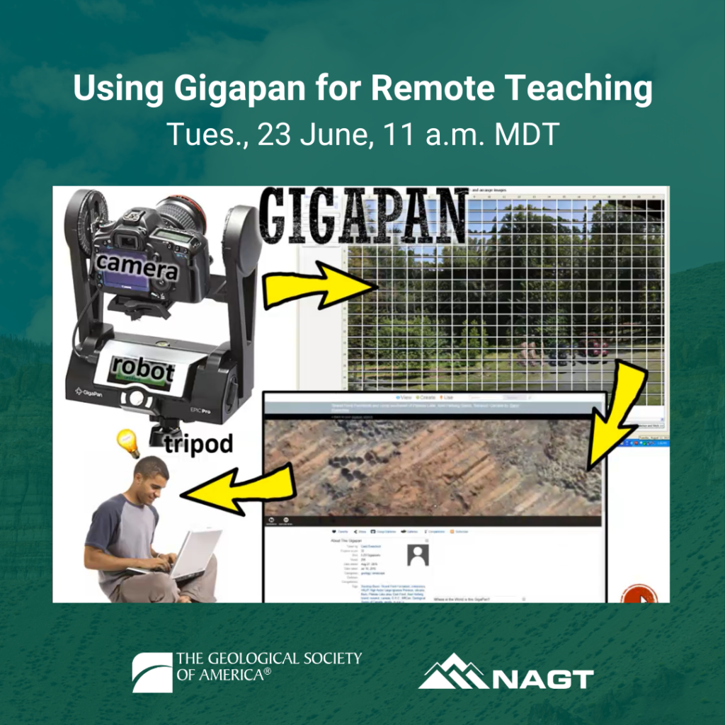
Tuesday, June 23, 11 a.m. MDT Gigapan or 7 pm Brussels time
Gigapan: Gigapixel panoramas are high resolution 2D images that combine ‘zoomed out’ context with the power of ‘zoomed in’ details. Applied to teaching geology remotely, they are valuable web-based tools for exploring geoscience concepts with students at scales ranging from the landscape to the outcrop to hand samples, to thin sections, to SEM. GigaPans can be embedded in webpages or desktop-based Google Earth KML tours as elements in virtual field experiences, potentially gaining power when combined with DEMs, 3D models of outcrops or samples, 360° spherical photos, or video. They can also be used as ‘virtual samples’ in times when student access to samples is limited. This webinar will cover the technical side of producing your own GigaPan images via two hardware/software packages as well as how to deploy extant CC-licensed GigaPans in your own remote teaching and outreach.
Gigapan Abstract
-
-
-
-
- 05-06-2020
-
-
-
GSA free webinar series “Using Digital Field Tools for Remote Teaching”
Dear GSA Associated Society Leaders,
GSA and NAGT will be hosting a free webinar series “Using Digital Field Tools for Remote Teaching”. The current scheduled webinars in this series are below. If these are successful, 2-3 additional webinars will be scheduled.
Tuesday, June 16, 11 a.m. MDT Google Earth
Tuesday, June 23, 11 a.m. MDT Gigapan
Tuesday, June 30, 11 a.m. MDT Virtual WorldsAbout this Webinar Series:
The goals of the GSA/NAGT Digital Field Tools For Teaching Webinar Series are to (1) increase digital literacy in the geosciences, and (2) provide professional development to instructors and teachers on digital tools and alternative field experiences. Each of the digital tools presented will have a 30 minute overview, a 15 minute presentation on tips for using the digital tool for remote teaching, along with 15 minutes of Q&A. When possible, those wanting additional exposure will have the option to also attend a Thursday webinar which will provide hands-on practice with the digital tool presented that week.
Speakers:
Steve Whitmeyer, James Madison University (Google Earth)
Drew Laskowski, Montana State University (Google Earth)
Callan Bentley, Northern Virginia Community College, Annandale Campus (Gigapan)
Jennifer Piatek, Central Connecticut State University (Gigapan)
Jacqueline Houghton, University of Leeds (Virtual Worlds)
Mark Helper, University of Texas at Austin (Virtual Worlds)The webinar audience will be geared toward faculty running summer field camp and/or those planning for remote fall courses; however, anyone is welcome to attend. A webinar summary is at the end of this email.
I’m writing to inquire if your organization would be interested in being a promotional partner for this webinar series. As a promotional partner you agree to advertise the webinar to your membership. We will acknowledge you during the webinar, on flyers, and on the registration page.
If you are interested, please email Jennifer Nocerino so that I can begin advertising right away. Once I have confirmation from all of our promotional partners, I will send an email with webinar registration details and social media flyers that can be distributed.
Thank you and I look forward to hearing back from you soon.
Respectfully,
Jennifer Nocerino
-
-
-
-
- 02-06-2020
-
-
-
Remains of 60 Mammoths Discovered in Mexico
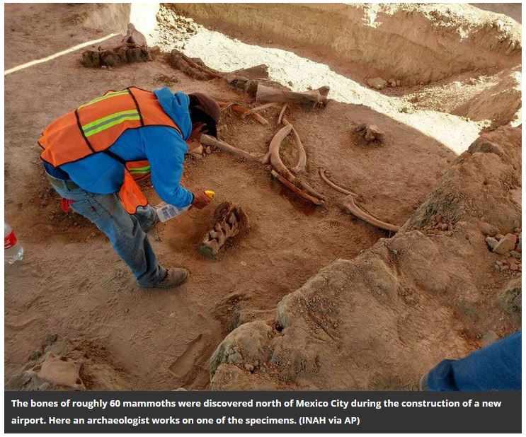
Last year, archaeologists discovered huge earthen pits dug by humans some 15,000 years ago in an area just north of Mexico City. Inside those pits were the remains of more than a dozen mammoths, some of which showed signs of being butchered. This discovery led researchers to hypothesize that these pits were in fact traps laid by human ancestors to capture huge, prehistoric prey, reported the Associated Press in 2019.
Now, another mammoth graveyard has been found just six miles away, though archaeologists so far see no signs of human involvement in the demise of the roughly 60 mammoths that have been unearthed, reports Mark Stevenson for the Associated Press.
More details here on this webpage
Video from the Smithsonianmag about what killed the mammmoths
-
-
-
-
- 30-05-2020
-
-
-
Join the GeoConnect³d webinar series with a focus on the Roer-to-Rhine area (crossing Belgium-France-Germany-Luxembourg-Netherlands)
GeoConnect³d is promoting a series of four online events aiming to demonstrate how the innovative methodology being developed by the project can be used to improve the geological understanding and, consequently, to identify geological potential and opportunities within a region.
Which topics will be covered? HOW TO REGISTER for FREE-> please go to this website
The events are subdivided in the following themes and dates:
1) Geoheritage & Geotourism – 22 June 2020
2) Groundwater – 23 June 2020
3) Geothermal energy – 24 June 2020
4) Subsurface management – 26 June 2020Who can be interested?
The events have a focus on the Roer-to-Rhine area of interest (crossing Belgium-France-Germany-Luxembourg-Netherlands). Any stakeholders interested in any of the four themes in this region are welcome to join us and give their valuable feedback about what we are developing in the project. The invitation is also extended to stakeholders in other regions with an interest in the project and its goals.THEME 1: GEOHERITAGE and GEOTOURISM
In Europe, there are endless geologic features with significant scientific, educational, cultural, and/or aesthetic value. These areas are commonly well-known by local communities, but rarely incorporated into geological models. GeoConnect³d is a cross-disciplinary project, funded under the GeoERA geo-energy theme, with a focus on providing relevant geological context for anyone interested in geology at surface and subsurface. This is being done through the structural framework model and annotated geomanifestations, which define any distinct local expression of ongoing or past geological processes. These manifestations, or anomalies, often point to specific geologic conditions and, therefore, can be important sources of information to improve geological understanding of an area.HOW CAN GEOCONNECT³D HELP?
In this ‘geoheritage and geotourism session’ of our series of online events, we will start from a European overview of these topics and align that with the GeoConnect³d methods and preliminary results in order to explore the relevance of the project for promoting geoscience value.
Agenda
09:30-09:45 Welcome and instructions for interactive session
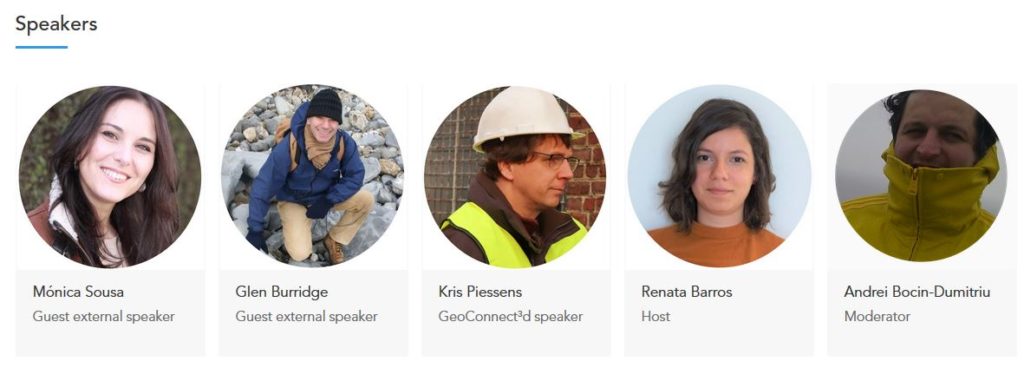
09:45-09:55 Geoheritage: Protecting geodiversity and raising the visibility of geology in our lives | Guest speaker: Mónica Sousa (Portuguese Association of Geologists)
09:55-10:05 Geotourism: A prominent commercial and outreach opportunity for geoscience | Guest speaker: Glen Burridge (European Federation of Geologists)
10:05-10:20 Tackling the fundamental blind spot: can geology be explained and understood intuitively? | GeoConnect³d speaker: Kris Piessens (Geological Survey of Belgium)
10:20-10:55 Q&A and interactive session focusing on receiving feedback from guest speakers and audience about the GeoConnect³d method
10:55-11:00 General recap of the online event series
THEME 2: GROUNDWATER
Groundwater is a crucial resource for humankind, as well as for natural ecosystems. Therefore, any subsurface use considers how it will affect shallow groundwater reserves. At least, that is how it should be, because these interactions are complex and uncertain.
This problem is approached by two GeoERA projects. VoGERA is a groundwater project that looks unidirectionally how groundwater is affected and aims at building generic schemes aided by results from case studies. GeoConnect³d is a cross-disciplinary project, funded under the geo-energy theme, focusing on providing the correct geological context to properly identify and evaluate pathways for interaction, also between the deeper and shallower subsurface.HOW CAN GEOCONNECT³D HELP?
In this ‘groundwater session’ of our series of online events, we will start from the VoGERA case and then align that with the GeoConnect³d methods to explore the relevance of those techniques for groundwater management.
Agenda
09:30-09:45 Welcome and instructions for interactive session
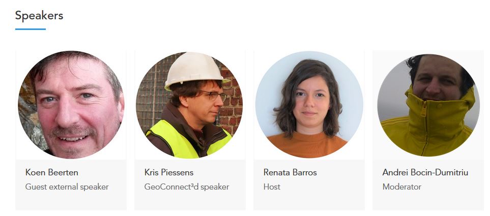
09:45-10:00 Groundwater at the receiving end: taking into account deep subsurface activities | Guest speaker: Koen Beerten (Belgian Nuclear Research Center)
10:00-10:20 The deep and the drinkable: linking and understanding these subsurface worlds | GeoConnect³d speaker: Kris Piessens (Geological Survey of Belgium)
10:20-10:55 Q&A and interactive session focusing on receiving feedback from guest speaker and audience about the GeoConnect³d method
10:55-11:00 Recap of lessons and expectations towards GeoConnect³d
THEME 3: GEOTHERMAL ENERGY
The causes and consequences of climate change have made us think of an energy transition where local geo-resources, including geothermal energy, come to the foreground. GeoConnect³d is a cross-disciplinary project, funded under the GeoERA geo-energy theme, with a focus on providing relevant geological context to allow for the identification of opportunities in the shallower and deeper subsurface.HOW CAN GEOCONNECT³D HELP?
In this ‘geothermal session’ of our series of online events, we will start from an overview of an actual geothermal installation and align that with the GeoConnect³d methods and preliminary results to explore the relevance of those techniques for geothermal resource management.Agenda
09:30-09:45 Welcome and instructions for interactive session
09:45-10:00 How deep is deep geothermal energy in Wallonia (Belgium)? | Guest speaker: Estelle Petitclerc (Geological Survey of Belgium)
10:00-10:20 Bold and daring decisions: how to let everyone in on subsurface obscurities | GeoConnect³d speaker: Kris Piessens (Geological Survey of Belgium)
10:20-10:55 Q&A and interactive session focusing on receiving feedback from guest speaker and audience about the GeoConnect³d method
10:55-11:00 Recap of lessons and expectations towards GeoConnect³d
THEME 4: SUBSURFACE MANAGEMENT
In the previous sessions we have explored how a few specific uses of the subsurface can be discussed in a meaningful and understandable geological context. We have done that using two approaches that we develop in the GeoConnect³d project: the structural framework and geomanifestations. These make geological information visible in an intuitive way, but also allow to test how complete our knowledge and understanding is.HOW CAN GEOCONNECT³D HELP?
In this final ‘subsurface session’ of our series of online events, we will, drawing from the input and suggestions from speakers and attendants of previous sessions, explore new case studies that will inspire the final year of the project.Agenda
09:30-09:45 Welcome and instructions for interactive session
09:45-10:00 Multiple uses of the deep subsurface: foreseeable interactions | GeoConnect³d speaker: Isaline Gravaud (French Geological Survey)
10:00-10:20 Discussing the invisible: from generic to custom tailored understanding | GeoConnect³d speaker: Kris Piessens (Geological Survey of Belgium)
10:20-10:55 Q&A and interactive session
10:55-11:00 General recap of the online event series
-
-
-
-
- 28-05-2020
-
-
-
The future of geoscience virtual summit on 10 June 2020
UPDATE | Further details on keynote speakers and sessions announced for The future of geoscience virtual summit on 10 June.
Session 1: Perception of Geoscience in Society
Keynote Speaker – Lucy CraneSession 2: Perception of Geoscience in Business
Keynote Speaker – Tom BackhouseSession 3: The Decline of Geoscience Students
Keynote Speaker – Professor Iain StewartTo find out more click on the link: https://lnkd.in/dWMTSpr
Registration is free and there are a limited amount of places remaining.
#futuregeo #geolsoc #virtualsummit
-
-
-
-
- 23-04-2020
-
-
-
The Moon, this far amazing object ! Do you want to see it on a digital base on your screen ?
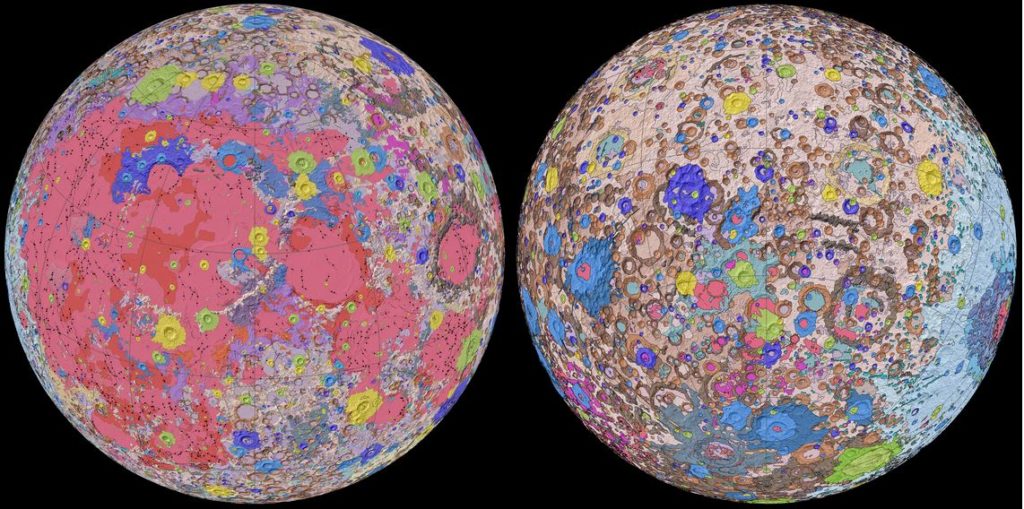
You can download at different sizes the geological map of the Moon on the USGS website
The result is the Unified Geologic Map of the Moon, which you can download from the USGS website. It is effectively a color-coded blueprint of the patchwork of rocks, materials, and structures that make up the surface of Earth’s natural satellite.The colors on the map represent the discrete geologic units of the Moon that are discernible at a map scale of 1:5,000,000 … that is, 1 mm on the map equals 5,000,000 mm on the lunar surface (5 kilometres). It provides an important template for lunar exploration because it enables local regions, such as those that might be explored by astronauts, to be studied in detail while simultaneously allowing correlation to other areas on the lunar surface. Thus, scientists can be sure they are referencing the same rock unit. This may also lays the foundation for starting discussions about resources that can make sustained exploration of the Moon a reality in future years.
Detailed Description
Orthographic projections of the Unified Geologic Map of the Moon showing the geology of the Moon’s near side (left) and far side (right) with shaded topography from the Lunar Orbiter Laser Altimeter (LOLA). This geologic map is a synthesis of six Apollo-era regional geologic maps, updated based on data from recent satellite missions. It will serve as a reference for lunar science and future human missions to the Moon. Credit: NASA/GSFC/USGS
If you want to see a video dealing with the geology of the moon, please follow this link to see the video posted on youtube
-
-
-
-
- 21-04-2020
-
-
-
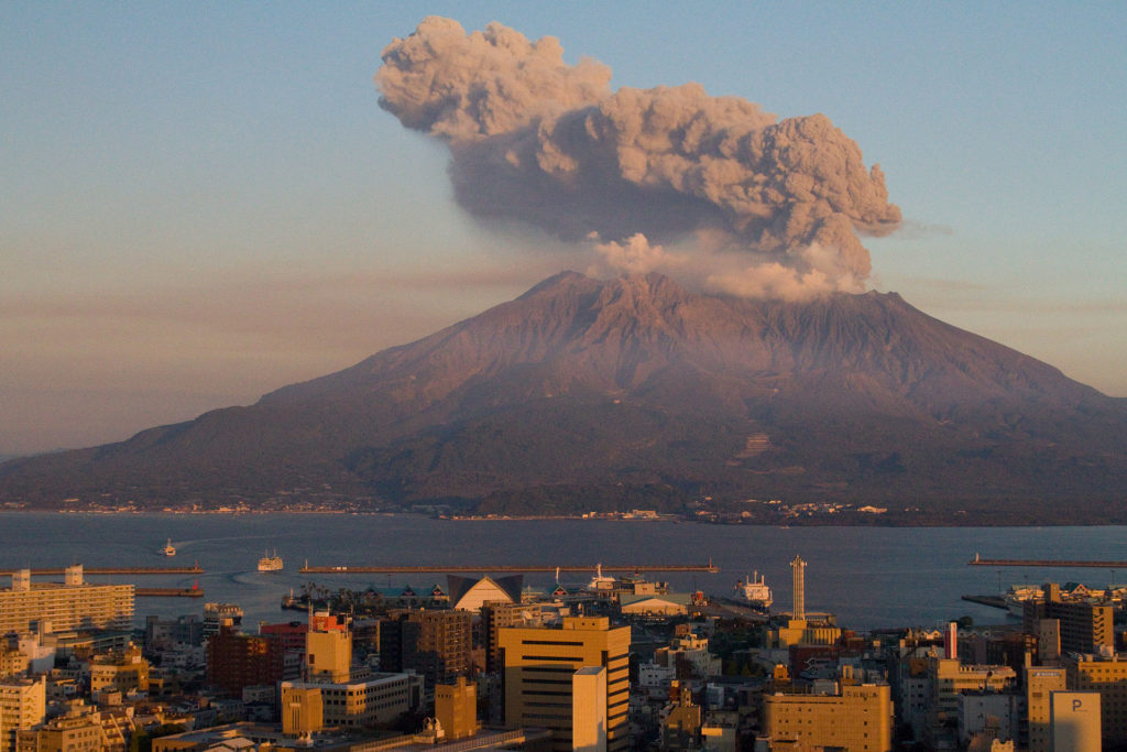
Are Cosmic Rays a Key to Forecasting Volcanic Eruptions? an ongoing work started by the japanese scientists on the Sakurajima volcano
A combination of relativistic particles and artificial intelligence may provide a new way to forecast when a volcano could erupt. A new pilot study, conducted on a highly active Japanese volcano, used a type of high-energy particle called a muon to map the interior structure of the volcano. When analyzed with machine learning algorithms, these maps could help diagnose when a volcano is about to blow. Thus far, the feasibility of the method has been examined on only one volcano, but it could eventually be more widely applied as the technique is further refined.
Sakurajima is one of the most active volcanoes in the world, the view on the volcano is right across Kagoshima. Credit: Kimon Berlin, CC BY-SA 2.0
For over a decade, scientists have been using muography to peer inside volcanoes around the world. The new work by the Japanese team, recently published in Scientific Reports, was the first effort to use muographic images to forecast eruptions.
To read a bit more on this topic, you can either consult:
– the EOS publication, Citation: Johnson-Groh, M. (2020), Are cosmic rays a key to forecasting volcanic eruptions?, Eos, 101, https://doi.org/10.1029/2020EO142927. Published on 21 April 2020.
– the publication of the Nature Scientific reports: Nomura, Y., Nemoto, M., Hayashi, N. et al. Pilot study of eruption forecasting with muography using convolutional neural network. Sci Rep 10, 5272 (2020). https://doi.org/10.1038/s41598-020-62342-y
-
-
-
-
- 18-04-2020
-
-
-
Dear GB Members, after 1 month of Covid-19 quarentine and social distancing
How are you after 1 month of Covid-19 social restrictions and distancing ? Staying at home is for some of us very productive because there is less physical interactions and perturbations during working hours. For others, it is a time of increasing difficulties both for managing time, planning work, finding solutions to focus on the work, find possibilities to keep teaching on a remote place, etc.
So, it would be a good time to share a bit more between us the tips and tricks. I’m sure all of our members have seen, discovered or produced an incredible website, an amazing book reference, an accessible/free geological teaching course, nice videos explaining some aspects of a thematic field in geology, etc.
Whatever you have found or produced yourself, it would be nice to share it with all the Belgian colleagues and your GB members through our GB website/member areas.So please, don’t be shine and let us know what you would recommend to the others …
To do it, please forward any idea, document, website, pdf, link, etc. using the info@geologicabelgica.be email address and we will share all your suggestions in a dedicated post !
-
-
-
-
- 06-04-2020
-
-
-
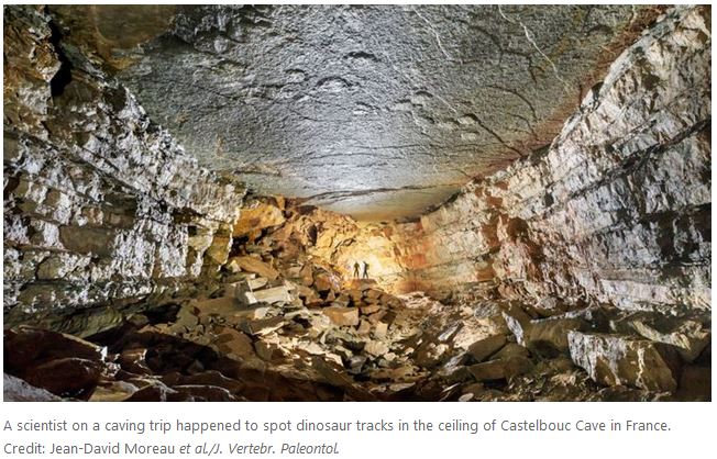
Gigantic dinosaur footprints are found on the roof of a cave
A scientist exploring deep inside a cave in France has discovered huge dinosaur footprints, measuring up to 1.25 metres long, made by some of the largest creatures ever to walk the Earth.
According to Jean-David Moreau at the University of Burgundy–Franche-Comté in France and his colleagues, the footprints probably belong to an unknown species of titanosaur, a category of long-necked herbivorous dinosaur that includes the heaviest and longest land animals in the planet’s history. The tracks were made 166 million to 168 million years ago, when three dinosaurs traversed the shoreline of a sea. The site was then at the planet’s surface, but geological processes have buried and tilted the sediments, and the prints are now on the cave’s roof, 500 metres underground.
Dinosaur footprints have often been discovered in mines and railway tunnels, but they are rarely found in natural caverns. The tracks were a chance discovery by one of the authors on a caving expedition in 2015. It’s a wonder they were ever found, as they can be reached only by way of a labyrinth of tight, frequently flooded crawl spaces 100 metres in length.
Reference: Jean-David Moreau et al. (2020). Middle Jurassic tracks of sauropod dinosaurs in a deep karst cave in France. Journal of Vertebrate Paleontology, https://doi.org/10.1080/02724634.2019.1728286
-
-
-
-
- 03-04-2020
-
-
-
12th International Geochronology Summer School: Dating Techniques in Environmental Research
Geochronology Summer School / Aug. 30-Sept. 3, 2020
Optional: 1 full day excursion Sept. 4, 2020Topics to be covered in lectures, excursions and workshops include dating techniques such as numerical methods (radiocarbon, exposure dating with cosmogenic nuclides, OSL, 137Cs, 210Pb, etc.), dendrochronology, anthracology, archaeomagnetic dating, palaeolimnology, as well as relative methods like soil weathering and Schmidt-hammer technique.
List of lecturers: Holger Gärtner (WSL), Paolo Cherubini (WSL), Markus Egli (Univ. of Zurich), Susan Ivy-Ochs (ETH Zurich/Uni Zurich), Dmitry Tikhomirov (ETH Zurich/Uni Zurich), Dennis Dahms (Univ. Northern Iowa), Irka Hajdas (ETH Zurich), Jérôme Poulenard (University Savoie Mont Blanc), Eileen Eckmeier (LMU University of Munich), Evdokia Tema (Univ. of Torino), Natacha Gribenski (Univ. of Bern), Nathalie Dubois (EAWAG) and others.
The Summer School is open to young researchers (PhD students and Post-Docs) worldwide. Participation is competitive and will be limited to a maximum of 20. The registration fee (750 CHF) includes accommodation (room sharing required), half board and lunch, field trips and teaching material.
Credit points: 3 ECTSDEADLINE FOR APPLICATIONS: April 30, 2020
-
-
-
-
- 30-03-2020
-
-
-
Maps of rivers around the world were created by Esri UK
For World Water Day, Esri UK used data to uncover watercourses in stunning detail.
These maps of rivers around the world were created by Esri UK, a mapping and spatial analytics company, from detailed elevation data collected using remote sensing techniques. The information was taken from Esri’s Living Atlas, one of the world’s largest collections of geographic information.By eliminating any vegetation or infrastructure, the maps show each river’s geomorphology as it would appear on bare ground. Elevation data can be valuable in highlighting river features and landforms that cannot be seen from normal satellite images, such as slight changes in elevation, run-off, levees, sediment deposits and how the land has changed over time.
One common method in collecting elevation data of this kind is to use a laser scan known as lidar, which measures distance by firing a laser at the ground, most often from a plane, to create a highly detailed picture of the elevation of the earth.The elevation data begins life as a greyscale colour ramp, mapping each elevation value by colour intensity. Using its mapping software, ArcGIS Pro, Esri UK applied different colours to the maps, making historic river paths, small tributaries and other details which cannot easily be seen from satellite images more clearly visible. To see a few examples, go to the webpage of the guardian site (Padma River, Bangladesh / Mississippi, United States / Brahmaputra River, Bangladesh / Amazon, Brazil etc…)
-
-
-
-
- 22-03-2020
-
-
-
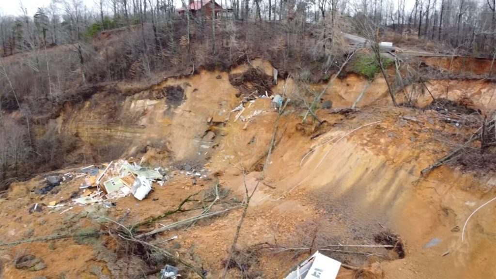
Impressive landslide along a rock cliff in Tennessee, USA
The landslide struck Saturday in Morris Chapel, Tennessee, located in the southwest part of the state after a hillside was weakened by the latest round of rainstorms that have saturated the area. A section of Glendale Road collapsed on Tuesday as parts of the hillside continued to slowly break off and tumble toward the Tennessee River below. Posted on February 20, 2020 on the fownews site. The video hereafter has been acquired with a drone showing the disaster area with the two houses destroyed and the large area affected by the landslide.
To see the video, follow this link on the foxnews website
Homes have been reduced to rubble after the landslide. (Hardin County Fire Department via Storyful)
-
-
-
-
- 21-03-2020
-
-
-
Impressive landslide along a highspeed train (TGV) line in France
5 March 2020, a TGV (high speed train) struck a landslide between Strasburg and Vendenheim in the Bas-Rhin area of France. The train remained upright, not least because it appears that it was a glancing blow rather than a direct collision, but 22 people were injured, one seriously. The landslide is a large rotational slip in a slope in a cutting. The displacement of the mid-section is quite large, but little of the debris appears to have reached the tracks. This prevented a more serious accident. The train, which had 348 passengers on board, was travelling 270 kilometres per hour (170 miles per hour) at the time of the collision.
-
-
-
-
- 20-03-2020
-
-
-
Impressive modification of the landscape around the Taal volcano after the eruption
On January 12, 2020, the Taal Volcano in the Philippines awoke from 43 years of quiet and began to spew gases, ash, and lava into the air. In the days and weeks that followed, the eruption dropped a layer of unusually wet, heavy ash on the surrounding landscape, withering vegetation and turning the lush fields and forests of Volcano Island a ghostly gray.
Two months later, the ash-damaged landscape still looks more like the Moon than the tropics. On March 11, 2020, the Operational Land Imager (OLI) on Landsat 8 acquired an image of Taal that underscores the consequences of the ashfall. For comparison, the other image shows the same area on December 6, 2019.
Aside from a few green promontories on the north side of the island, ash has altered much of the landscape, including several villages along the coasts. “Most of the ash has likely washed away by now, but signs of it will persist for millennia in the rock record,” explained Erik Klemetti, a volcanologist at Denison University. “Most of the ash that fell within the caldera is in the process of getting concentrated into gullies and streams or deposited into the lake.”
More details -> look at the Nasa webpage content
-
-
-
-
- 19-03-2020
-
-
-
Transforming energy science ground upwards
Since 2015, NERC and the BGS have been transforming a £31m vision for two geoenergy testbeds into a real research platform that draws in academics the length and breadth of the UK. Today, two sites are well on their way to being delivered; a £2m state-of-the-art scanning hub is up and running; hundreds of rock and fluid samples and open data reports are available; and geoscientists are assembling around the facilities to explore new research ideas, collaborations, and training opportunities. NERC senior science user Prof David Manning looks at the value of the scientific work delivered so far.
More details about the ongoing work – see the blog pages of the UK Geoenergy observatories
-
-
-
-
- 18-03-2020
-
-
-
Virtual tour of 31 U.S. National Parks from Home
The Geological Society of America – GSA – Virtually Tour 31 U.S. National Parks From Home via @googleearth: http://bit.ly/2QvA9kw
Direct link to tour: http://bit.ly/3b8socg, National Park Service
Science – Contents 20 March 2020 – Vol 367, Issue 6484 -> Antarctica Special Issue
Special issue Antarctica:
– Introduction to special issue, The frozen continent By Jesse Smith, Science20 Mar 2020: 1316-1317
– News, The lost colony By Eli Kintisch, Science20 Mar 2020 : 1318-1320 – Some 900,000 king penguins vanished without a trace. Why?
– Reviews, History, mass loss, structure, and dynamic behavior of the Antarctic Ice Sheet By Robin E. Bell, Helene Seroussi, Science20 Mar 2020: 1321-1325
– Reviews, The Southern Ocean and its interaction with the Antarctic Ice Sheet By David M. Holland, Keith W. Nicholls, Aurora Basinski, Science20 Mar 2020 : 1326-1330
– Reviews, The uncertain future of the Antarctic Ice Sheet By Frank Pattyn, Mathieu Morlighem Science20 Mar 2020: 1331-1335
-
-
-
-
- 17-03-2020
-
-
-
Watch out: a new open access journal – Quaternary Science Advances
Quaternary Science Advances – Open access
ISSN: 2666-0334 – Copyright © 2020 Elsevier Ltd.
Want to check the first submitted papers for Volume 1 or read the guide for authors ? -> go to their webpage
-
-
-
-
- 16-03-2020
-
-
-
Exploitation of 15.7 billion standard cubic meters of oil equivalents in the Norwegian North Sea
The Norwegian Petroleum Directorate (NPD) revealed Monday that it has granted its consent for the start-up of the Skogul field in the North Sea. The NPD is a governmental specialist directorate and administrative body, according to its website. Established in 1972, it reports to the Norwegian Ministry of Petroleum and Energy and its main office is in Stavanger, Norway.
Last week, the NPD revealed that its estimate of total proven and unproven petroleum resources on the Norwegian Continental Shelf (NCS) is about 15.7 billion standard cubic meters of oil equivalents. This is 104 million more than as of December 31, 2018, the NPD highlighted, adding that 48 percent of the resources have been sold and delivered.
Aker BP describes itself as a fully-fledged exploration and production company with exploration, development and production activities on the NCS. Measured in production, Aker BP is one of the largest independent oil companies in Europe, according to the company’s website.
Aker BP is headquartered at Fornebu outside Oslo, Norway, and has offices in Stavanger, Trondheim, Harstad and Sandnessjoen.
-
-
-
-
- 15-03-2020
-
-
-
Field trip cancelled on March 27, 2020
!! Currently, the entire country is obliged to severe measures to slow down #COVID19. Due to these restrictions, the Geologica Belgica field trip planned on March 27, 2020 with Dr Julien Denaeyer on the Eifelian series is thus postponned to another date that will be shared later !!
-
-
-
-
- 13-03-2020
-
-
-
ebook Earth from the NASA
From its origins, NASA has studied our planet in novel ways, using ingenious tools to study physical processes at work—from beneath the crust to the edge of the atmosphere. We look at it in macrocosm and microcosm, from the flow of one mountain stream to the flow of jet streams. Most of all, we look at Earth as a system, examining the cycles and processes—the water cycle, the carbon cycle, ocean circulation, the movement of heat—that interact and influence each other in a complex, dynamic dance across seasons and decades.
For all of the dynamism and detail we can observe from orbit, sometimes it is worth stepping back and simply admiring Earth. It is a beautiful, awe-inspiring place, and it is the only world most of us will ever know.
If you want to download the ebook, please follow this link through the NASA website where you can choose the desired format
-
-
-
-
- 03-03-2020
-
-
-
BELQUA NC workshop on the 26th of March 2020
BELQUA – 2020 Annual Scientific Workshop Brussels, Thursday 26 March 2020
The BELQUA National Committee organizes its 2020 Annual Scientific Workshop at the “Academy Palace” (Hertogstraat / Rue Ducale, Brussels), on Thursday 26 March 2020. The workshop aims to review ongoing Quaternary research in Belgium and abroad. In particular young scientists are encouraged to contribute, but senior scientists are most welcome too to present their ongoing research.
Key-note: Prof. Sue Dawson (University of Dundee) – Tsunami risk in the North Atlantic.
Practical information about the venue and the details of the oral program will be distributed in a later mailing.
We are looking forward to meeting you in Brussels.
The convenors, Vanessa Heyvaert (RBINS) & Bea De Cupere (RBINS)
-
-
-
-
- 02-03-2020
-
-
-
Académie Royale de Belgique – Prix et subventions 2020 : appel à candidatures
Date de dépôt des candidatures : 15 décembre 2020 (sauf subventions Agathon De Potter et bourse Vanhove-Vonnêche)
To see all the different prizes and the details on how to apply, please consult the following webpage
Here follows some of them relevant for earth sciences:
– Prix Henri Buttgenbach (minéralogie, pétrographie, paléontologie) – 1000 €
– Prix Agathon de Potter (géologie) – 1000 €
– Prix Charles Lagrange (modélisation du système Terre) – 1000 €
– Prix Adolphe Wetrems (sciences naturelles) – 1000 €
– Subvention du Fonds Agathon de Potter – octobre (astronomie, physique, mathématiques, chimie, géologie, biologie animale, biologie végétale et microbiologie) – maximum 1000 € par subvention (date de dépôt des candidatures : 15 septembre 2020)
– Subvention du Fonds Camille Liégeois (recherches et voyages scientifiques) – 1000 €
-
-
-
-
- 01-03-2020
-
-
-
Check it out – Sandy coastlines under threat of erosion – NATURE letters
The study was published in the Journal Nature Climate Change and was conducted by scientists from the European Commission’s Joint Research Center, as well as universities in Spain, Portugal and the Netherlands. Paper published by Vousdoukas and colleagues – read it here online
Sandy beaches occupy more than one-third of the global coastline and have high socio economic value related to recreation, tourism and ecosystem services. Beaches are the interface between land and ocean, providing coastal protection from marine storms and cyclones. However the presence of sandy beaches cannot be taken for granted, as they are under constant change, driven by meteorological, geological and anthropogenic factors. A substantial proportion of the world’s sandy coastline is already eroding, a situation that could be exacerbated by climate change. Here, we show that ambient trends in shoreline dynamics, combined with coastal recession driven by sea level rise, could result in the near extinction of almost half of the world’s sandy beaches by the end of the century. Moderate GHG emission mitigation could prevent 40% of shoreline retreat. Projected shoreline dynamics are dominated by sea level rise for the majority of sandy beaches, but in certain regions the erosive trend is counteracted by accretive ambient shoreline changes; for example, in the Amazon, East and Southeast Asia and the north tropical Pacific. A substantial proportion of the threatened sandy shorelines are in densely populated areas, underlining the need for the design and implementation of effective adaptive measures.
-
-
-
-
- 29-02-2020
-
-
-
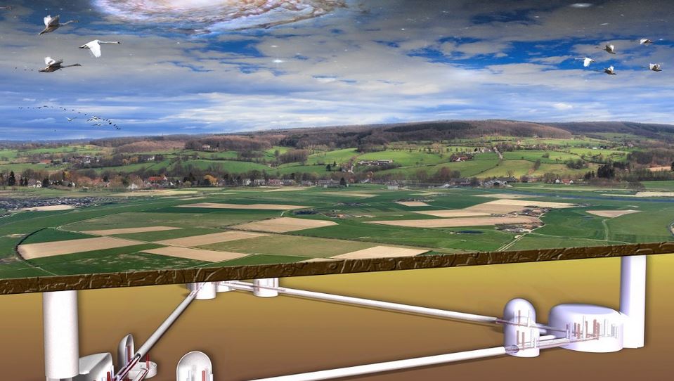
Einstein telescope – INTERREG Euregio Meuse-Rhine
The first measurements recently showed that the subsurface of Limburg seems ‘quiet enough’ for the Einstein Telescope. Now the European grant for the follow-up research has also been approved. The University of Liège will coordinate the consortium consisting of 11 institutes from the Netherlands, Belgium and Germany. Together they will map the subsurface of the Meuse-Rhine Euroregion. They will also develop a full-scale cryogenic mirror for the Einstein Telescope.
From groundwater models to ‘the triangle’The study will run from the beginning of 2020 to the end of 2022. The researchers will work on an underground monitoring system and a model. This will enable them to accurately monitor and predict issues such as groundwater levels and possible earthquakes in the area. The study will also show exactly where the Einstein Telescope could be located. This requires an equilateral triangle with sides of 10 km at a depth of 200-300 meters. Important factors are the type of subsoil, the stability of the soil and groundwater fluctuations at certain locations.
Frank Linde is project leader for the Einstein Telescope at Nikhef and is enthusiastic: “It is fantastic that this project has been approved. This will enable us to work on a missing piece of the puzzle in our ambition: determining the optimal location for the Einstein Telescope in the border region.”
Frédéric Nguyen is Professor of Applied Geophysics at the University of Liège. He explains why this research is necessary: “Depth drilling and large-scale geophysical research are expensive. As a result, underground information is generally sparse. Not only here, but in many places in Europe and the world. That is why it is necessary to support initiatives aimed at improving knowledge of geology and the subsurface.”
He also explains the general importance of geological research: “We will gain new insights into geology, groundwater and seismic conditions. This is important for society, because the subsurface is our main supplier of many natural resources, such as water, minerals and energy. But also because the soil can accommodate large civil engineering structures. With this research, we can reduce geological risks, including those associated with earthquakes.”
L’Union européenne vient d’approuver le projet Interreg V-A EMR E-TEST, coordonné par des scientifiques de l’Université de Liège*. Doté de 15 millions d’euros, ce projet vise à permettre au consortium de partenaires impliqués dans le grand projet du télescope Einstein, d’effectuer des premières études sur les sous-sols de l’endroit pressenti pour l’installation du télescope, dans la région des Trois Frontières au sein de l’Euregio Meuse-Rhin, ainsi que la construction d’un prototype – jamais réalisé à ce jour – de grand miroir suspendu à température cryogénique.
More information:
– on the ULiège website
– on the official website
– on the website of the Vice-Président de la Wallonie – Willy Borsus
-
-
-
-
- 27-02-2020
-
-
-
PhD defenses – DOCTORAT EN SCIENCES – ULiège
Promoteurs : N. FAGEL et K. EL HAMMOUTI – Co-tutelle avec l’Université Mohamed 1er de Oujda
Jemaa AMAKRANE : Master spécialisé, filière géoenvironnement et génie civil
présentera le SAMEDI 14 MARS 2020 à 9h00, à l’Université Mohamed 1er, Oujda, Maroc, l’examen en vue de l’obtention du grade académique de Docteur en Sciences.
Cette épreuve consistera en la défense publique d’une dissertation intitulée : « Les argiles Néogènes des bassins de Guercif-Taourirt : Reconstitutions paléoenvironnementales et potentiel de valorisation ».
-
-
-
-
- 22-02-2020
-
-
-
Evaluating the mineral commodity supply risk of the U.S. manufacturing sector by Nedal T. Nassar et al., Science Advances, 21 Feb 2020: Vol. 6, no. 8, eaay8647, DOI: 10.1126/sciadv.aay8647
Trade tensions, resource nationalism, and various other factors are increasing concerns regarding the supply reliability of nonfuel mineral commodities. This is especially the case for commodities required for new and emerging technologies ranging from electric vehicles to wind turbines. In this analysis, we use a conventional risk-modeling framework to develop and apply a new methodology for assessing the supply risk to the U.S. manufacturing sector. Specifically, supply risk is defined as the confluence of three factors: the likelihood of a foreign supply disruption, the dependency of U.S. manufacturers on foreign supplies, and the ability of U.S. manufacturers to withstand a supply disruption. The methodology is applied to 52 commodities for the decade spanning 2007–2016. The results indicate that a subset of 23 commodities, including cobalt, niobium, rare earth elements, and tungsten, pose the greatest supply risk. This supply risk is dynamic, shifting with changes in global market conditions.
-> More details on this paper, check it out here
-
-
-
-
- 21-02-2020
-
-
-
New collection of papers about the geology of Mars in Nature journal
InSight at Mars
NASA’s InSight lander arrived on Mars in late 2018. Primarily a geophysics mission, InSight aims to constrain the planet’s present-day geologic activity and its interior evolution. Here, we present the first results from the InSight mission, including analyses of seismometer, magnetometer, weather station and other instrument data from the lander’s first year on Mars.
-
-
-
-
- 20-02-2020
-
-
-
1000 Jaar Vlaamse Bouwgeschiedenis bewaard in steen: Van Adinkerke tot Kessenich
09/03/2020 – VORST – Begeleider: Michiel DUSAR
Natuursteen is medebepalend voor het uitzicht van ons gebouwd patrimonium maar legt ook ontstaan en evolutie ervan bloot. Ontleding van het historische natuursteengebruik toont een verrassende regionale verscheidenheid van oost naar west en van zuid naar noord, in relatie met het natuurlijke landschap en de socioeconomische context. Wij doorkruisen alle Vlaamse provincies op zoek naar zowel prestigieuse gebouwen in historische stadskernen als naar eenvoudige dorpskerken die deze verscheidenheid illustreren, en wippen daarbij over huidige lands- en gewestgrenzen heen. Natuursteenlandschappen tekenen zich af; hun interpretatie
zegt alles over herkomst en waardering van de onderscheiden natuursteensoorten. De 20 en 21 eeuw brengen een eigen dynamiek in de toepassing van natuursteen en leiden tot de vraag hoe het verder moet.Meer info (locatie, datum, uur, prijs): click hier voor de samenvatting en hier voor de inschrijven
-
-
-
-
- 15-02-2020
-
-
-
Atlas van Nederland in het Holoceen
Atlas van Nederland in het Holoceen: Landschap en bewoning vanaf de laatste ijstijd
Peter Vos, Jos Bazelmans, Michiel van der Meulen, Henk Weerts | Nederlands | Hardcover | € 49,99
Het Nederlandse landschap is sinds het einde van de laatste ijstijd, 11.700 jaar geleden, voortdurend veranderd. Waar we nu rondlopen was ooit een toendra, een rivierdelta of een ondiepe zee. Het einde van de laatste ijstijd markeerde het begin van een nieuwe geologische periode, het Holoceen – de relatief warme periode waarin we nog steeds leven. Vanaf dat moment kreeg Nederland langzaam zijn huidige vorm.
De Atlas van Nederland in het Holoceen bestaat uit bijzondere kaarten, aangevuld met archeologische en historische informatie. Voor dertien verschillende momenten sinds de ijstijd geven deze kaarten de oude geografische situatie weer, op basis van tienduizenden boringen en nieuw geologisch, bodemkundig en archeologisch onderzoek. Deze schitterende atlas geeft daarnaast een verrassend beeld van de positie van de mens in het landschap. Hoe maakte hij gebruik van de mogelijkheden die het landschap hem bood? En op welke wijze heeft hij het landschap naar zijn hand gezet?
De Atlas van Nederland in het Holoceen verandert voorgoed uw blik op het ons zo vertrouwde landschap.Deze negende druk is ingrijpend herzien. De inleiding is uitgebreid met een hoofdstuk over de vorming van de Nederlandse kust. Er zijn twee nieuwe kaarten voor 250 v.Chr. en 1250 n.Chr. toegevoegd met uitvoerige toelichting. Alle kaarten zijn herzien naar de laatste stand van kennis.
De Atlas van Nederland in het Holoceen is samengesteld onder verantwoordelijkheid van TNO, Deltares en de Rijksdienst voor het Cultureel Erfgoed, de nationale kenniscentra voor de Nederlandse bodem, ondergrond en erfgoed. De kaarten zijn gemaakt door Peter Vos (TNO/Deltares).
An English translation of that book will soon be available !
-
-
-
-
- 14-02-2020
-
-
-
Obituary – Jozef HUS
De directie van het Koninklijk Meteorologisch Instituut (KMI), Het personeel van het Geofysisch Centrum te Dourbes,
Mevrouw Souad Ech-Chakrouni, zijn naaste medewerkster, geven u met grote droefheid kennis van het overlijden vanMijnheer Jozef Jan Edward HUS, Professor – Doctor in de Fysica en lid van de Koninklijke Academie voor Overzeese Wetenschappen,
geboren te Balen op 28 januari 1942, in vrede van ons heengegaan op 11 februari 2020 te Chimay.
La Direction de l’Institut royal de Météorologie (IRM), Le personnel du Centre de Géophysique de Dourbes, Madame Souad Ech-Chakrouni, sa plus proche collaboratrice, ont la profonde tristesse de vous faire part du décès de
Monsieur Jozef Jan Edward HUS, Professeur – Docteur en Physique et Membre de l’Académie Royale des Sciences d’Outre-Mer,
né à Balen le 28 janvier 1942, parti dans la paix et la discrétion le 11 février 2020 à Chimay.
-
-
-
-
- 13-02-2020
-
-
-
Les poussières du continent blanc, une recherche de Nadine Mattielli (ULB) dans “PITCH”
7 minutes et 14 dias: Nadine Mattielli présente ses recherches sur la traque des poussières de l’Antarctique et autour du monde dans “PITCH”.
PITCH, c’est le nom d’une émission de vulgarisation scientifique sur la télévision locale bruxelloise BX1, dont l’ULB est partenaire.Chaque dimanche à 18h30 (ou le lendemain sur ULBTv), un chercheur de l’ULB prend la parole pour expliquer son sujet de recherche, ses collaborations ou ses missions sur le terrain. Le tout en 14 visuels de 30 secondes chacun!
le Prof. Nadine Mattielli (G-Time, Faculté des Sciences, ULB) évoque ses recherches sur les poussières de l’Antarctique (the link open a new window with a youtube video).
-
-
-
-
- 12-02-2020
-
-
-
Using robots and drones on the Skarv installation in the Norwegian Sea
Aker BP has teamed up with Cognite, a global industrial AI software-as-a-service company that supports digital transformation of heavy-asset industries, to explore how robotics systems can make offshore operations safer, more efficient and more sustainable.
The companies will perform several tests using robots and drones on the Skarv installation in the Norwegian Sea this year. The systems will be tested to gauge their performance in autonomous inspection, high-quality data capture, and automatic report generation.
Among the robots involved in the initiative is Spot, the quadruped robot developed by Boston Dynamics. Cognite and Aker have already tested Spot’s mobility in simulated oil and gas environments.
-
-
-
-
- 11-02-2020
-
-
-
Vlaamse Unesco Commissie – woensdag 1 april 2020 – infodag in Brussel
Als jij dagelijks bezig bent met erfgoedbeheer, natuurbescherming, landschapszorg of streekontwikkeling, dan nodigen wij jou graag uit op onze infodag over Unesco-gebiedserkenningen!
Unesco’s Werelderfgoed is bij de meeste mensen wel gekend, maar Unesco heeft ook nog andere keurmerken voor waardevolle gebieden: Unesco Biosfeergebieden en Unesco Geoparken. Die willen we graag ook meer bekendheid geven in Vlaanderen.
De Vlaamse Unesco Commissie organiseert daarom in samenwerking met de Regionale Landschappen en de Vlaamse Agentschappen Natuur en Bos, en Onroerend Erfgoed op woensdag 1 april 2020 een infodag in Brussel om de verschillende gebiedserkenningen van Unesco beter te leren kennen, en om te kijken hoe ze sporen met het huidige en toekomstige Vlaamse beleidskader voor de bescherming van erfgoedsites en natuurgebieden.
De infodag is gericht op experts en beleidsmedewerkers vanuit de verschillende overheden, organisaties en instituten in Vlaanderen die betrokken zijn bij erfgoed, natuur, landschap en streekontwikkeling.
Een gedetailleerd programma en registratie voor deelname volgen later nog.
-
-
-
-
- 10-02-2020
-
-
-
Conference: Unravelling pore-scale processes in geomaterials given by Prof. Veerle Cnudde – Dept. Geology – RG PProGRess
Physical, chemical and biological weathering has a constant effect on the earth’s landscape. This also impacts our building infrastructure, as stone and masonry are damaged by a combination of different processes, such as chemical attack, biological colonization, water infiltration and changes in temperature. Fluid flow, reactive transport, nucleation, dissolution, precipitation and mass transport are crucial processes occurring inside the pore system of geomaterials.
To fully understand the macroscopical behaviour of geomaterials in this context, their pore scale properties and processes have to be understood. The stone’s mineralogy and pore structure strongly affect key internal pore scale processes. These processes have been studied indirectly by micro- and macroscopic observations and laboratory experiments. Although this provides valuable information, the key drivers of these processes are to be studied at the pore scale.
To explore these dynamic pore-scale processes, several non-destructive 3D and 4D methods are currently available. These tools provide additional important insights. Unravelling pore-scale processes in combination with pore scale modelling is an essential step towards understanding and predicting a geomaterial’s macroscopic behaviour correctly.
The presentation discusses the current possibilities and challenges in non-destructive pore-scale imaging of geomaterials and how this data can be used as input for fluid flow models and their validation. Additional new developments at the synchrotron and on lab-based X-ray systems related to material characterization as well as to the understanding of pore-scale processes are discussed. Examples will be given of different experiments related to the characterization and the imaging of dynamic pore scale processes in (geo)materials.
When: March 03, 2020 – 7-8 pm | Where: Aud.A2, Building S9, Campus Sterre, Krijgslaan 281, 9000 Ghent
Free entrance, you can freely register on this website to inform the organizers on the number of attendees
-
-
-
-
- 9-02-2020
-
-
-
35th IAS Meeting in Prague
The 35th International Meeting of Sedimentology supported by the International Association of Sedimentologists. The meeting will be held, for the first time, in Prague, Czech Republic, on June 23–25, 2020. Prague, the capital of the Czech Republic, belongs to the world’s most admired jewels of historical urban architecture. The Meeting will be held at Conference Centre of the Vienna House Diplomat Hotel providing an excellent location. More details: see website
February 24, 2020 at 23:59:59 PST | Deadline for abstract submission
-
-
-
-
- 8-02-2020
-
-
-
Japan Puts Its Mark on Geologic Time with the Chibanian Age
The newly named period in the Pleistocene identifies a key moment in geological history: the last time Earth’s magnetic poles switched places.
Earth’s newest geologic time interval has been named after a jurisdiction outside Tokyo, Japan. The International Union of Geological Sciences (IUGS) recently ratified the name “Chibanian,” meaning “Chiba age,” for a period of time stretching from 770,000 to 126,000 years ago, during the Pleistocene epoch.Equating to the Middle Pleistocene subepoch, the Chibanian is named after Chiba, one of Japan’s 47 prefectures, and marks the first time a Japanese name has been used in the geological timescale as well as in a Global Boundary Stratotype Section and Point (GSSP).
More details on the GSSP: look at the EOS publication
Citation: Hornyak, T. (2020), Japan puts its mark on geologic time with the Chibanian Age, Eos, 101, https://doi.org/10.1029/2020EO139453. Published on 30 January 2020.
-
-
-
-
- 7-02-2020
-
-
-
Raamovereenkomst VLA17-4.1 – Vlaams Planbureau voor Omgeving opdrachten
In het kader van de raamovereenkomst VLA17-4.1 besteedt het Vlaams Planbureau voor Omgeving opdrachten uit voor het beschrijven en documenteren van tijdelijke ontsluitingen van geologische waarde (website). Dit kunnen werven zijn ten gevolge van infrastructuurwerken maar ook actieve of verlaten groeves. Momenteel werden reeds vijf ontsluitingen gedocumenteerd in het kader van deze overeenkomst en een zesde (Langenberg Diest) wordt momenteel verwerkt. De resultaten hiervan kunnen teruggevonden worden in de DOV-verkenner in de laag boringen en opdrachten door te zoeken in deze lagen op code ‘VLA17’ (rapporten zijn gekoppeld aan de opdracht). Er kan algemeen gezocht worden naar ontsluitingen op DOV door in de laag boringen de zoekterm ‘ontsluiting’ in te geven. Stalen die verzameld worden in het kader van deze opdracht worden bewaard in de Vlaamse Geotheek.
Raamovereenkomst VLA17-4.1 loopt eind juni 2020 af en er is nog budget beschikbaar om enkele ontsluitingen te documenten. Gezien de grote meerwaarde van het goed documenteren van zulke tijdelijke ontsluitingen voor onze kennis van de Vlaamse ondergrond zouden wij hierbij graag een oproep willen doen om interessante huidige of toekomstige ontsluitingen waar jullie van op de hoogte zijn of actieve/verlaten groeves die waardevolle geologie bevatten en volgens jullie een rapportage verdienen (voorlopig werd enkel groeve Roelants te Lubbeek beschreven) aan ons mee te delen.
Citation: Jasper Verhaegen of Vlaams Planbureau voor Omgeving (VPO)
-
-
-
-
- 6-02-2020
-
-
-
Antarctic Ice Cores Might Be Older Than Dirt
Using cosmogenic nuclide dating, scientists determined a 10-meter core just below the surface to be over a million years old.
One of the oldest sections of the cores, according to Bergelin, is likely to be around 2.6 million years old and at least no younger than the dirt above it, which was dated at 1.6 million years old.More details on the discovery: look at the EOS publication
Citation: Hendricks, J. (2020), Antarctic ice cores might be older than dirt, Eos, 101,
https://doi.org/10.1029/2020EO139799. Published on 06 February 2020.
-
-
-
-
- 01-02-2020
-
-
-
The new core building of the Geological Survey of Belgium in Binche
Ici repose le sous-sol belge: 40 kilomètres de carottes déménagés à Binche
De nouveaux conservatoires, aménagés sur le site de l’ancien triage-lavoir de Péronneslez-Binche, dans le Hainaut, accueillent désormais 40 km de carottes de sondage. Recueillis au cours des 150 dernières années, ces échantillons géologiques nous renseignent sur la composition du sous-sol de la Belgique. Ils nous indiquent notamment où se trouvent les aquifères, quelles zones sont propices à la géothermie et où nous pourrions stocker du CO2.Hier rust de Belgische ondergrond: 40 kilometer aan boorkernen verkast naar Binche
De Belgische ondergrond ligt bovengronds in Péronnes-lez-Binche, in Henegouwen. In een gloednieuwe opslaghal vind je meer dan 40 kilometer aan boorkernen. De cilindervormige stalen zijn de voorbije anderhalve eeuw verzameld en geven een preciezer beeld wat zich onder onze voeten bevindt. Ze vertellen ons waar watervoerende lagen zitten, welke gebieden geschikt zijn voor geothermie, en waar we CO2 zouden kunnen opslaan.Check out the paper in Science Connection either in French, either in Dutch for more details and pictures.
Verhuizen van de boorkernen / Déménagement des carottes de forage
Moreover, the GSB is ready to acquire/store/preserve any core from a Belgian site before loosing an important part of our subcrop heritage. Don’t hesite to contact Marleen De Ceukelaire [mdeceukelaire(at)naturalsciences.be] if you have important cores that you might give to the GSB.
-
-
-
-
- 26-01-2020
-
-
-
SSSB International Excursion from 17 to 20 May 2020 in Burgundy, France
Soil Science Society Belgium SSSB – BBV-SBSS
Mission of the SSSB. The soil science society of Belgium is an organization gathering all actors of the soil science community in Belgium. The society informs these actors of soil-related challenges and opportunities, recent developments and contributes to the preservation and enhancement of soil resources for future generations.
The excursion is organized by Prof. Bruno Delvaux and will focus on the “Diversity of wine-growing terroirs in Burgundy“. We will leave Belgium on Sunday 17 and arrive in Dijon at 5 pm. We will be in the vineyard plots and in the tasting cellars from Monday 18 to Wednesday 20 May. We will leave Dijon on the 20th at 5 pm to reach Belgium in the late evening. News will come in the coming days about the final organization and registration processes – keep an eye on our website
Karen Vancampenhout
Vice-President of the Soil Science Society of Belgium
-
-
-
-
- 25-01-2020
-
-
-
BELQUA – 2020 Annual Scientific Workshop – Brussels, Thursday 26 March 2020
Call for Abstracts
The BELQUA [website] National Committee organizes its 2020 Annual Scientific Workshop at the “Academy Palace” (Hertogstraat / Rue Ducale, Brussels), on Thursday 26 March 2020. The workshop aims to review ongoing Quaternary research in Belgium and abroad. In particular young scientists are encouraged to contribute, but senior scientists are most welcome too to present their ongoing research.
Key-note lecturer: Prof. Sue Dawson (University of Dundee) – Tsunami risk in the North Atlantic.Abstracts for oral presentations (max 2 pages) are to be sent to bdecupere[at]naturalsciences.be and Vanessa.heyvaert[at]naturalsciences.be by Sunday 1 March 2020.
As usually, NO poster session will be organized. Practical information about the venue and the details of the oral program will be distributed in a later mailing. We are looking forward to meeting you in Brussels.
The convenors,
Vanessa Heyvaert (RBINS) & Bea De Cupere (RBINS)
-
-
-
-
- 24-01-2020
-
-
-
Journée technique pierre naturelle en voiries et espaces publics: nouvelles pratiques – 8 avril 2020
Deep Geological Disposal of Radioactive Waste: The role of Geoscience – 30 march 2020
Deep Geological Disposal of Radioactive Waste: The role of Geoscience at Rupert Beckett Lecture Theatre.
Michael Sadler Building University Of Leeds, Leeds, LS2 9DA, United Kingdom -> more details: website
-
-
-
-
- 23-01-2020
-
-
-
XIX Congress of the UISPP – 1-6 Septembre 2020
XIX Congress of the UISPP – 1-6 Septembre 2020
Call for contributions – Session: The oldest ‘mastering’ of the underground world / Appel à contribution pour la session: Les premières appropriations du monde souterrain.
More details, consult the website or the leaflet in English / French
-
-
-
-
- 22-01-2020
-
-
-
Limburgse contactdag natuuronderzoek 2020 – zaterdag 15 februari 2020
Jaarlijks stellen het Provinciaal Natuurcentrum en het Netwerk Natuuronderzoek resultaten van recent natuuronderzoek voor aan geïnteresseerde natuurliefhebbers.
-
-
-
-
- 21-01-2020
-
-
-
New GB issue vol 22/3-4 -> check it out
The New GB issue is now available in the restricted member area for download and also, as usual, all the different papers are available online in PDF format !
-
-
-
-
- 20-01-2020
-
-
-
DOV studiedag 13 december 2019
Databank Ondergrond Vlaanderen (DOV) stelde op een druk bijgewoonde studiedag de visie 2030 en een nieuw geologisch en hydrogeologisch ondergrondmodel voor Vlaanderen voor. Herbeleef de studiedag.
Een nieuw geologisch en hydrogeologisch ondergrondmodel voor Vlaanderen is beschikbaar
Het Vlaamse geologisch en hydrogeologisch ondergrondmodel voor Vlaanderen zijn opgemaakt door VITO, in opdracht van het Vlaams Planbureau voor Omgeving van het Departement Omgeving én de Vlaamse Milieumaatschappij (VMM) samen. Voor het eerst hebben we een gelijklopend geologisch en hydrogeologisch ondergrondmodel, een onderzoeksresultaat gebaseerd op dezelfde uitgebreide wetenschappelijke gegevensbasis. Het is een verdere detaillering van het eerste Geologisch 3D-model uit 2013 en het Hydrogeologische model uit 2007. Databank Ondergrond Vlaanderen (DOV) biedt dit nieuwe model aan naast de oude.
Nu, in 2019, is het G3Dv3- en H3Dv2-model afgewerkt. Die modellen karakteriseren de ondergrond in 117 geologische en 133 hydrogeologische lagen, gestapeld volgens ouderdom. Beide modellen vormen daarbij de meest gedetailleerde en up-to-date modellen van de Vlaamse ondergrond en trachten daarbij een zo volledig mogelijk overzicht te geven van de geologie en hydrogeologie op gelijk welke locatie in Vlaanderen. Dit maakt ze tot een handige samenvatting van de geologische kennis die doorheen de afgelopen eeuwen over Vlaanderen werd verzameld. Een gebiedsdekkend onderzoeksresultaat waar Vlaanderen fier kan op zijn.Het spreekt voor zich dat een goed inzicht in de opbouw van de ondergrond een grote rol speelt bij het duurzaam benutten van onze ondergrond en het grondwater voor toepassingen zoals diepe geothermie, ondergronds ruimtegebruik, duurzaam gebruik van delfstoffen, droogteproblematiek etc.. Dit model werd trouwens gecompileerd op basis van meer gedetailleerde deelmodellen, die inzicht verschaffen in specifieke eigenschappen van de verschillende watervoerende lagen, sediment- of gesteentepaketten.
De gekoppelde onderzoeksresultaten van het Departement Omgeving en de Vlaamse Milieumaatschappij zijn beschikbaar via het webportaal van Databank Ondergrond Vlaanderen (DOV):
Link naar DOV geologisch 3D-model
Link naar DOV hydrogeologisch 3D-model.
Delfstoffenverkenner uitgebreid met Delfstoffenmodel Zand en Grind van Maas en Rijn
Een andere nieuwigheid die aan bod kwam tijdens de studiedag is de Delfstoffenverkenner die sinds kort werd uitgebreid met het “Delfstoffenmodel Zand en Grind van Maas en Rijn”.
Dit is het tweede delfstoffenmodel dat DOV aanbiedt. Eerder werd al het delfstoffenmodel leem gepubliceerd.Dit voxelmodel toont de zanden en grinden van Maas en Rijn, afgezet tijdens het Quartair in het oosten van Vlaanderen. Het modelgebied omvat het Kempens Plateau en het Belgische deel van de Roerdalslenk inclusief de grindterrassen langsheen de Maas.
de voxel model
-
-
-
-
- 18-01-2020
-
-
-
PRIZE D4D EDITION 2020
Prize D4D rewards outstanding initiatives that use digitisation and new technologies as a lever for development towards achieving the sustainable development goals.
PARTICIPATION
Everyone with a convincing project or innovative idea on Digital for Development. Clear link with Belgium and partner countries of the Belgian University Development Cooperation.
CATEGORIES & PRIZES
The winning innovative idea or startup ‘iStartUp’ is awarded an internship in an incubator for 25 000 EUROS.
The winning success story ‘iStandOut’ is awarded a credit line of 10 000 EUROS.
The winning public award ‘iChoose’ receives a cash prize of 5 000 EUROS.Deadline: February 28, 2020.
More details: dowload the flyer and consult the website
-
-
-
-
- 17-01-2020
-
-
-
Slope processes in challenging environments – tools, approaches and perspectives
Workshop @ the Royal Museum for Central Africa – 11 March 2020
Slope processes and the hazards they pose affect landscapes and societies at variable spatial and temporal scales. Their study relies on the combination of various tools and approaches. Remote sensing – space-borne, aerial or field-based – often plays a major role. When it comes to studying these processes in challenging environments (i.e., remote, steep topography, context of data-scarcity, etc.), common research strategies need to be questioned.
Combining expert talks and a poster session, this workshop aims at offering an opportunity to foster exchanges of ideas and experiences among experts, students and young researchers (PhD and postdocs) regarding the study of slope processes in challenging environments.Registration is free of charge but mandatory for all participants.
Deadline for registration is 20th of February.More details: dowload the flyer and consult the website
-
-
-
-
- 16-01-2020
-
-
-
Geopark Schelde Delta
If you want to be informed by their activities and follow them, you can subscribe at the Geopark Schelde Delta newsletter sent out using mailchimp by giving your email at the bottom of this page
-
-
-
-
- 14-01-2020
-
-
-
Exposition about natural stones in Liège
La pierre, toute une carrière ! – du 6 janvier au 21 février
Au-delà du traditionnel tailleur de pierre, venez découvrir sur plus de 5 étages, la large gamme de profils professionnels qu’offrent les métiers de la pierre, de l’extraction à la mise en œuvre du produit.
Au travers de panneaux didactiques, photos, vidéos mais aussi d’exposition de matériaux et d’œuvres d’art en pierre du pays, venez plonger dans l’univers des architectes, graveurs, tailleurs, marbriers, géologues, sculpteurs, etc. qui vivent de ces nobles matériaux.
L’exposition est le résultat d’un partenariat entre différents acteurs du réseau pierre : l’association Pierres et Marbres de Wallonie, le Pôle de la Pierre, la Confédération Construction, le Centre d’Interprétation de la Pierre à Sprimont, le CEFOMEPI et Hainaut Développement avec son projet interreg Objectif Blue Stone.
Where: Espace Wallonie de Liège, Place Saint-Michel, 86 – 4000 Liège
Ouvert du lundi au vendredi, de 8 h 30 à 17 h / Fermé le 2ème lundi de chaque mois
En savoir plus
-
-
-
-
- 10-01-2020
-
-
-
New book from the Royal Academy of Sciences
Dear colleague,
I would like to inform you that the Royal Academy of Sciences, Letters and Fine Arts of Belgium has just published in the series “Nouvelle biographie nationale – supplement 1” the 115-page book entitled: « Les précurseurs et les grands noms de la géologie belge, nés entre 1719 et 1900 ».
Any additional information can be found through the following links:Cher(e) collègue,
Je me permets de vous informer que l’Académie royale des Sciences, des Lettres et des Beaux-Arts de Belgique vient de publier dans la série « Nouvelle biographie nationale – supplément 1 » l’ouvrage de 115 pages intitulé : « Les précurseurs et les grands noms de la géologie belge, nés entre 1719 et 1900 ».
Toute information complémentaire peut être trouvée par les liens suivants :Beste collega
Ik wil u mededelen dat de Koninklijke Academie voor Wetenschappen, Brieven en schone Kunsten van België onlangs in de serie “Nouvelle biographie nationale – supplement 1” het 115-pagina’s tellende boek getiteld: « Les précurseurs et les grands noms de la géologie belge, nés entre 1719 et 1900 ».
Aanvullende informatie vindt u op de volgende koppelingen:Léon Dejonghe
http://www.academieroyale.be/fr/accueil/
https://academie-editions.be/
https://academie-editions.be/biographie/389-les-precurseurs-et-les-grands-noms-de-la-geologie-belge-nes-entre-1719-et-1900.html
-
-
-
-
- 08-01-2020
-
-
-
The fires in Australia can alter or not the climate?
Many people are learning about the local effects of the fires on the generation of Pyrocumulonimbus clouds because it has been well-documented in the popular media. Fire, smoke particles, and instability in the atmosphere generate massive thunderstorms. However, what about the larger scale impacts on the atmosphere? According to various reports, 6-7 million hectares of land have burned in the Australian bushfires (twice the size of Belgium), and that number is likely to grow. Could this heat source alter atmospheric circulations?
-
-
-
-
- 06-01-2020
-
-
-
The end of the lunar dynamo
Magnetic measurements of the lunar crust and Apollo samples indicate that the Moon generated a dynamo magnetic field lasting from at least 4.2 until <2.5 billion years (Ga) ago. However, it has been unclear when the dynamo ceased.
Here, we report paleomagnetic and 40Ar/39Ar studies showing that two lunar breccias cooled in a near-zero magnetic field (<0.1 µT) at 0.44 ± 0.01 and 0.91 ± 0.11 Ga ago, respectively. Combined with previous paleointensity estimates, this indicates that the lunar dynamo likely ceased sometime between ~1.92 and ~0.80 Ga ago. The protracted lifetime of the lunar magnetic field indicates that the late dynamo was likely powered by crystallization of the lunar core.More details on this paper, consult the website of Science Advances where you can find the pdf of the paper published by Saied Mighani and colleagues
Reference: Mighani et al., Sci. Adv. 2020; 6 : eaax0883 – 1 January 2020
-
-
-
-
- 05-01-2020
-
-
-
Drilling the world’s hottest geothermal well – Venelle 2 in Larderello, Italy
The Venelle-2 is the hottest geothermal well in the world, where downhole conditions considerably exceeded the critical temperature of geothermal brines, reaching more than 500°C at a depth of 2.9 km.
The well was drilled in the Larderello geothermal field in Italy, the birthplace of geothermal power production, within the framework of the DECRAMBLE (Drilling in dEep, Super-CRitical AMBients of continentaL Europe) project running between 2015 and 2018.
For the full #GeothermalFactsandStats blog post, click here and follow us!
-
-
-
-
- 31-12-2019
-
-
-
Happy new Year 2020 to all the GB members
Last picture and message of the year to wish you all an exciting new year 2020. Best wishes from Geologica Belgica.
-
-
-
-
- 8-12-2019
-
-
-
Les Mees: a spectacular and unusual rockfall in France
On 2 December 2019 a spectacular rockfall occurred above the village of Les Mees in Alpes de Haute Provence, France. The failure, which was triggered by the exceptional rainfall that has occurred through the autumn, is reported to have developed on a steep rock bluff known as Les Pénitents. The blocks, which must weigh over a thousand tonnes, destroyed a house.
The rocks are eroded columns formed from the Valensole Formation, a Miocene and Pliocene conglomerate formed from subalpine debris. The images suggest that the rock mass has few discontinuities such as joints, which both allow it to form these large pillars and enable the detachment of large, coherent blocks when failures occur. In this case, large rockfalls are likely to be comparatively infrequent but to have very high potential cost.
-
-
-
-
- 6-12-2019
-
-
-
Flemish government grant allocation to the Flemish universities. Deadline 31-12-2020
Dear Sir, Madam,
The Flemish government allocates a grant to the Flemish universities (the so called ‘OJO’ grant) to develop training and career development initiatives for young researchers (PhD’s and postdocs). The goal of these activities are both scientific development as well as a more broader, professional development.These activities are set up by the Doctoral Schools at each university, sometimes in collaboration with external organisations.
A lot of scientific associations/societies and centers of expertise already organise activities that could be interesting for doctoral students and postdocs. To encourage and support such activities, the Doctoral Schools have decided to provide grants of maximum 5.000€ for one-day activities and maximum 8.000€ for activities of two or more days (the exact amount that will be allocated will depend on the exact budget overview that will be submitted). Examples of initiatives are workshops, summer schools, conferences, …
We would like to invite your organization to submit a proposal for activities.The criteria for eligibility are:
– Active participation of young researchers (for example via hands-on activities, poster or oral presentations)
– Participation of young researchers of minimum three Flemish universities (preferably all five)
– Young researchers can participate free of charge. It is allowed to ask for a contribution for catering.
– The initiative has to take place before 31/12/2020.The allocated budget can only be used for the transport (economy class for flights) and hotel/sustenance costs (max. 250€ per day) and the honorarium (max. 250€) of renowned international guest speakers/scientists. Further conditions can be found in the application form/Aanvraagformulier.
-
-
-
-
- 5-12-2019
-
-
-
Decarbonising cities with geothermal district heating: how to finance it? 13 December 2019 from 8:30 to 14:30
This seminar is organised as a partnership between the European geothermal industry and European local authorities committed to the energy transition to facilitate the uptake of this clean renewable energy technology. In particular, this workshop organized in the framework of the GEORISK project and the HeatNet NWE project in association with the Covenant of Mayors aims at best answering the following issues:
– Role of local planning in enabling RES investments, notably for heating and cooling
– Impact of local authorities in enabling the business model of geothermal projects
– Barriers to deploying geothermal district heating and cooling projects
– Policy solutions for facilitating deployment of geothermal district heating and cooling
– Financing geothermal projects*The HeatNet NWE Project is co-funded by the EU Interreg North-West Europe Programme.
REGISTRATION
Location > Copa Cogeca – Rue de Trèves 61, 1040 Bruxelles : More details – program of the day
-
-
-
-
- 3-12-2019
-
-
-
11th International Brown Coal Mining Congress: BROWN COAL – ALTERNATIVE DIRECTIONS OF APPLICATION
Dear Sirs,
On behalf of the Organisational Committees I kindly invite you to participate in the 11th International Brown Coal Mining Congress under the theme : “BROWN COAL – ALTERNATIVE DIRECTIONS OF APPLICATION”
The Congress will be held in Poland, Bełchatów from 20 to 22 April 2020.
I also invite you to prepare and write a scientific paper of your authorship that will be published in the COLLECTION SCIENTIFIC PAPERS and will be posted on the Congress website.The International Brown Coal Mining Congress is one of the largest mining industry events in Poland, attended by scientists from many universities, business leaders, economists and representatives of banks and insurance companies from Poland and abroad. The topics discussed during the Congress will be devoted to the broadly understood mining industry, including, energy security and modern technologies used in the mining industry.
Congress meetings will enable not only to exchange of experience and views of participants of different backgrounds but also give an opportunity to establish new business contacts. We intend to include the following issues in the subject scope of the Congress:
1. The role of lignite in European countries and worldwide.
2. Challenges facing the lignite industry in the context of the decarbonisation of the power industry.
3. New lignite-based areas and technologies.
4. Lignite as an alternative for other energy media.
5. Gasification of coal.
6. Changes in global lignite production and utilization trends.
7. Poland’s energy mix until the year 2050.
8. Lignite resources as a guarantee of energy security.
9. The role of lignite in balancing and stabilising energy systems.
10. Open-cast lignite mining – a time-intensive investments in new deposits and mining fields.
11. Coal technologies with prospects.
12. Lignite as substrate, fertiliser and raw material
13. Energy production in coal-fired powerplants ensuring security of energy supply without geopolitical risk.
14. Poland as a country endowed with brown coal deposits, using its resources prudently.
15. Lignite mining quantities and their future outlooks.
16. Environmental impact of opencast mines.
17. European climate policy and the striving towards carbon emission reduction.
18. Modern carbon capture and storage (CCS) technologies.
19. Reclamation and revitalisation of mining areas.
20. Continuous efficiency improvements of lignite-fired powerplants as a condition for maintaining their competitiveness among energy producers in Poland and worldwide.
-
-
-
-
- 1-12-2019
-
-
-
Conférence-Débat sur les volcans des Virunga – Benoit SMETS – 18/12/2019
Venez suivre la conférence-débat sur les volcans des Virunga dans la région volcanique la plus active d’Afrique. Cette thématique sera présentée par Benoit Smets, volcanologue au Musée Royal de l’Afrique Centrale, le 18 décembre prochain de 18h à 21h. Au plaisir de vous y retrouver nombreux.
Organisé par Association des Anciens de la Faculté de droit de l’UNamur (ADANam) et l’Association des Géologues Anciens de Namur (AGLAN)
Pour s’inscrire : Participation de 15€ à verser avant la conférence sur le compte BE47 0018 2628 5280 avec la mention “18/12/19 +
Nom du/des participant(s)”. Participation gratuite pour les étudiants et les membres du personnel de l’UNamur.
Lieu: Faculté de droit, Rempart de la Vierge 5 à 5000 Namur
-
-
-
-
- 18-11-2019
-
-
-
Conférence sur la géothermie: “Géothermie en Hauts-de-France” – O. LOUART – 04/12/2019
This conference is organised by the Société Géologique du Nord at the “Maison Régionale de l’Environnement et des Solidarités – MRES – 23 Rue de Gosselet, 59000 Lille, France”. FREE Entrance
-
-
-
-
- 8-11-2019
-
-
-
Radon 2019 campaign in Belgium and more specifically in Wallonia
For more details on this campaign, you can consult:
– the website of the Federaal Agentschap voor Nucleaire Controle (FANC) / Agence fédérale de Contrôle Nucleaire (AFCN)
– the online webgis where the 2019 Radon concentrations/risk are visible throughout Wallonia
-
-
-
-
- 7-11-2019
-
-
-
Obituary – Frans Gullentops – Prof. em. KU Leuven
Past president (1980-1981) of Société belge de Géologie / Belgische Vereniging voor Geologie, co-founding association of Geologica Belgica
Putte, 26.1.1924 – Holsbeek, 27.10.2019
Frans Gullentops on Geologica Belgica excursion to Diestian ferruginous sandstone in Scherpenheuvel-Zichem, 5 June 2010.On 27 October 2019, Frans Gullentops sadly passed away at the age of 95. From the 1950’s onwards, Frans has been an active researcher in the field of geomorphology and landscape evolution with particular emphasis on periglacial processes and landforms. Frans has studied several fluvial and aeolian deposits in Belgium through detailed sedimentological analysis, the study of palaeosoils and palaeoecology, to reconstruct the formation of the landscapes in Belgium during the Quaternary and Tertiary. Frans Gullentops has been actively involved in the Belgian Association for Quaternary Research, BELQUA. In fact, he has been one of the co-founders of BELQUA in 1968 and was the first secretary of the association with prof. Macar as president – he later also became president of BELQUA. He has been president of the National Centre for Geomorphic Research (Centre National de recherches geomorphologiques – Nationaal centrum voor geomorfologisch onderzoek) and promoted the creation of several geomorphic maps in Belgium. Frans has kept international contacts and is well known to many geoscientists who have worked on periglacial processes in the second half of the 20th century. Not only has he been involved in activities of INQUA, he also has led several international geomorphic field trips in Belgium. For several decades, Frans Gullentops has inspired many geomorphologists, geographers, geologists, quaternary scientists, with his enthusiasm and through the many ideas and theories on landscape evolution he brought up in his lectures and especially during the many field trips he organized or participated in. After his retirement in 1990, he remained active and in 2001 he published together with a few other Belgian Quaternary geoscientists an overview of the various Quaternary lithostratigraphic units in Belgium in the journal Geologica Belgica. He still participated occasionally in BELQUA field trips until 10 years ago when his physical condition no longer allowed it. Nevertheless, during occasional encounters in our institute in the last decade, he still exchanged his ideas on the formation of pingo’s in Belgium, on ice floods in Belgian river valleys, and on the meander evolution of the Semois river in the Ardennes to name just a few. He never stopped thinking as a geoscientist.
Gert Verstraeten
Chair, department Earth and Environmental Sciences, KU Leuven
-
-
-
-
- 1-11-2019
-
-
-
Kimberly-Clark Distinguished Lectureship Award to Prof. Veerle Cnudde (UGent)
Lecturer 2020: Professor Veerle Cnudde, Ghent University (Belgium)
More details: International Society for Porous Media: Kimberly-Clark Distinguished Lectureship AwardTitle of the lecture: Unravelling pore-scale processes in geomaterials: lecture flyer
Physical, chemical and biological weathering has a constant effect on the earth’s landscape. This also impacts our building infrastructure, as stone and masonry are damaged by a combination of different processes, such as chemical attack, biological colonization, water infiltration and changes in temperature. Fluid flow, reactive transport, nucleation, dissolution, precipitation and mass transport are crucial processes occurring inside the pore system of geomaterials. To fully understand the macroscopical behavior of geomaterials in this context, their pore scale properties and processes have to be understood. The stone’s mineralogy and pore structure strongly affect key internal pore scale processes. These processes have been studied indirectly by micro- and macroscopic observations and laboratory experiments. Although this provides valuable information, the key drivers of these processes are to be studied at the pore scale. To explore these dynamic pore-scale processes, several non-destructive 3D and 4D methods are currently available. These tools provide additional important insights. Unravelling pore-scale processes in combination with pore scale modelling is an essential step towards understanding and predicting a geomaterial’s macroscopic behavior correctly.
The presentation discusses the current possibilities and challenges in non-destructive pore-scale imaging of geomaterials and how this data can be used as input for fluid flow models and their validation. Additional new developments at the synchrotron and on lab-based X-ray systems related to material characterization as well as to the understanding of pore-scale processes are discussed. Examples will be given of different experiments related to the characterization and the imaging of dynamic pore scale processes in (geo)materials.
-
-
-
-
- 31-10-2019
-
-
-
Excursion « Seuil du Poitou »,
Vendredi 13, samedi 14 et dimanche 15 mars 2020 : excursion « Seuil du Poitou », organisée principalement par nos collègues Thierry Gaillard, Mickael Moreau, Alexandra Laurent, avec plusieurs autres intervenants.
Objet de l’excursion : Karst et sédimentation d’une plateforme carbonatée : rôle des discontinuités sédimentaires du Bajocien et du Bathonien dans la répartition des structures d’écoulements souterrains préférentiels. Ressources en eau souterraine régionales.
Au programme (prévisionnel) :
– Jour 1 (vendredi 13) : vallée de la Vienne : recalage stratigraphique du Bajocien jusqu’à Civaux. Visite d’un karst « modèle réduit » : perte-galerie–résurgence de Lussac (option) ou exposé sur la grotte préhistorique de Bois Ragot – Visite de la centrale nucléaire de Civaux
– Jour 2 (samedi 14) : Les discontinuités du Bajocien autour de Poitiers – Visite du Site expérimental de l’Université – Présentation des collections d’ammonites de Gabilly et Cariou – Visite éventuelle du karst de Seneuil et point sur les datations des eaux du karst intra bajocien
– Jour 3 (dimanche 15 au matin) : visite du réseau de Cuchon. Ce réseau, récemment découvert, est le plus grand du seuil avec 4.15 km de développementMore details: la newsletter du Comité français d’Hydrogéologie
-
-
-
-
- 29-10-2019
-
-
-
Le P’tit Festival du Film d’Archéologie de Rochefort
LE P’TIT FESTIVAL DU FILM D’ARCHEOLOGIE DE ROCHEFORT, Mardi 26 Novembre 2019 à 19h00 au Centre Culturel des Roches – Entrée gratuite. “Néandertal, un cousin de – 176 500 ans”. Pour la 7ième édition consécutive, le P’tit Festival du Film d’Archéologie de Rochefort (PFFAR) invite le public à sa soirée de documentaires autour de l’archéologie ce mardi 26 novembre 2019 à 19h00. Un rendez-vous désormais annuel dans la programmation du Centre Culturel des Roches.
More details: P’tit Festival du film d’Archéologie de Rochefort
-
-
-
-
- 24-10-2019
-
-
-
2019 Awarded laureate during the Master Day
Geologica Belgica is happy to inform you that Femke Augustijns (KULeuven) was awarded for a Master thesis presentation entitled “Holocene Vegetation Reconstruction of the Zwarte Beek Catchment, Campine Area (Belgium). A Pollen-based and Multivariate Statistical Approach.” More details: Master Thesis Award
-
-
-
-
- 21-10-2019
-
-
-
MOOC (Massive Open Online Course) on Soils of the Tropics
Dear all,
Hereby I am happy to inform you that our MOOC (Massive Open Online Course) on Soils of the Tropics is available again on EdX.org:
https://www.edx.org/course/as-above-so-below-an-introduction-to-soils-ecosystems-and-livelihoods-in-the-tropics
This online course is a fun way to get comfortable with WRB, and to see why soil classification is important in understanding landscapes, ecosystems and land use. The MOOC is a collaboration between KU Leuven, ISRIC, the JRC and FAO, with the support of the Flemish University Council for Development Cooperation and the International Union of Soil Sciences. Many contributions ware made by partners in the tropics, whom you’ll meet in the virtual excursions and case studies that are discussed in the course.
Standard participation is free of charge! If you want to pursue certificate, a small fee is required.
Kindly help us spread the word to anyone interested!
Best regards,
Karen Vancampenhout
Vice-President of the SSSB
-
-
-
-
- 17-10-2019
-
-
-
FieldTrip in the Stavelot Massif
2019 awarded Laureates of the Van den Broeck medal on the field during the GB excursion in the region of Malmedy. More details (images, videos, documents, etc) for the GB members in the hidden part [Member login zone]
from left to right in the back: Timothy Debacker, Pierre Ghysel, Frédéric Favart, Martin Laloux, Eric Lemonne, Jean-Louis Pingot, Jonathan Michel, Isabelle Bélanger, Jean-Marc Marion
from left to right in the front: Bernard Delcambre, Serge Delabby, Bernard Mottequin, Virginie Dumoulin, Céline Vanneste, Alain Herbosch, Dominique Delsate
-
-
-
-
- 04-10-2019
-
-
-
FieldTrip in the Stavelot Massif
Dear participant,
Please find attached the final programme of our fieldtrip in the Stavelot Massif on Friday 4th October.
We had to change the meeting place as a quarry is exceptionally inaccessible to the public. The new venue is in Malmedy, parking Moviemills.
Fifty people will attend the fieldtrip. We ask you to try to come together to have a minimum of cars. If you come alone to Malmedy, we will try to group people there.
Don’t forget your yellow jacket and your helmet: they are mandatory to enter into the quarries.
The entrance fees to the Schieferstollen underground quarry are 7 € per person. We will collect the money during lunch time. Could you try to have the exact amount?
Best regards,
Aurélia Hubert-Ferrari (President) & Annick Anceau (Convener)
-
-
-
-
- 02-10-2019
-
-
-
Journée des Jeunes – Jongeren Dag of the GEOLOGICA BELGICA association
Dear members of Geologica Belgica,
We cordially invite you on Friday 18 October at Universiteit Gent:
– to the next meeting of the board of Geologica Belgica on Friday 18th of October at 12h00 (Agenda will follow)
– to participate in the Junior Day, on the same day at 14h00.During the Master Junior Day, there will be presentations of the best master theses of the current academic year.
The date for this meeting has been fixed traditionally at the third friday of October as confirmed by one of the previous board meetings. More details are provided in the attached letters (download here the program in Fr or in Nl).
Kind regards
Aurélia Hubert-Ferrari
President of Geological BelgicaProgram: (click here to download the pdf)
13:30-13:50 Valentin Jamart (ULiege)
Characterisation of the Kačák event (upper Eifelian) and it’s effects on paleobiodiversity.
13:50-14:10 Femke Augustijns (KUL)
Holocene Vegetation Reconstruction of the Zwarte Beek Catchment, Campine Area (Belgium). A Pollen-based and Multivariate Statistical Approach.
14:10-14:30 Jérôme Roland (ULB)
Understanding the geological history of Mars by dating martian meteorites.
14:30-14:50 Antoine Scohier (UMons)
Improving a flow meter device for long term cave dripping monitoring.
14:50-15:10 Lotte Verweirder (UGent)
Tsunamigenic potential of submarine landslides on passive margins: Case study for the Irish margin.
15:10-15:30 Sarah Robinet (ULiege)
Hypoxia during the Holocene on the NW Black Sea shelf: geochemical proxies.
15:30-15:50 Samir Mohammad (ULB)
Fractures Roughness Analysis in Luxembourg Sandstone.
15:50-16:10 Stijn Albers (UGent)
Lake sediment records of late Holocene proglacial floods from the San Lorenzo Icefield (Patagonia).
16:10-16:30 Narimane Chatar (ULiege)
Disparity of the mandible of primitive sabre-toothed felids from the Late Miocene of Batallones (Spain).16:30-16:50 Deliberation by the jury and proclamation of the laureate
-
-
-
-
- 09-07-2019
-
-
-
PalEurAfrica congress
Dear colleagues,
Please find here linked the PalEurAfrica2019 congress (2nd Circular) of the PalEurAfrica congress, the PalEurAfrica2019 congress (Registration Form), and the PalEurAfrica2019 congress (Abstract Template) (please return the two latter to PalEurAfrica2019@naturalsciences.be).
The Deadline for abstract submission is fixed on June 15th 2019.
As part of the PalEurAfrica network research project (www.PalEurAfrica.be), we are happy to invite you from September 10 to 13, 2019 to the Royal Belgian Institute of Natural Sciences (RBINS) for an international symposium on the Evolution and Paleoenvironment of Early Modern Vertebrates during the Paleogene.
This symposium will gather specialists who work on macro- and micropaleontology, bio- and isotope stratigraphy, paleoenvironment, paleogeography, and geology of Paleogene vertebrate bearing sites.
This international meeting will also celebrate the memory of one of our PalEurAfrica partners, Gregg F. Gunnell (1954-2017), who died tragically and unexpectedly in the middle of his career, having made significant contributions to our understanding of Paleogene vertebrate evolutionary history.
Kind regards,
The host committee
-
-
-
-
- 07-07-2019
-
-
-
Impact Factors (IF) of the GEOLOGICA BELGICA journal
The 2018 impact factor are now available. The IF of Geologica Belgica is 0.879. Our IF decreases a little bit but not too much.
Hereafter you can find the evolution since 2010:
2010 = 0.645
2011 = 0.773
2012 = 1.041
2013 = 0.636
2014 = 0.782
2015 = 0.762
2016 = 0.739
2017 = 0.914
2018 = 0.879.
The 5 year impact factor is 1.082.

